
Canyons are Earth’s most dramatic editing jobs – millennia of water and wind carving through rock to reveal stories written in stone. From Arizona’s layer-cake geology to Tibet’s vertical jungle-to-glacier marathon, these chasms offer more than scenic overlooks. They’re time machines, biodiversity vaults, and adventure playgrounds rolled into geological theatre. The question isn’t whether to visit one, but which deserves your finite vacation days.
We set out to answer that question with more than armchair speculation. Our methodology blended hard science with the ineffable – measuring depths in kilometres while weighing the worth of a condor’s shadow at sunrise. After evaluating 50 notable gorges across three weighted categories, factoring everything from endemic species counts to permit lottery odds, we’ve identified the planet’s 10 most remarkable canyons. Some will surprise you. Others confirmed what travellers have known since the first rim trail was blazed: certain places on Earth simply dwarf human imagination.

How We Ranked Earth’s Greatest Canyons
Creating a definitive canyon ranking required more than simply listing the deepest gorges. We began by assembling every notable canyon worldwide – from record-holding chasms to social media darlings, from remote wilderness cuts to accessible tourist magnets. This initial inventory captured the full spectrum: Arizona’s iconic Grand Canyon, Tibet’s mythical Yarlung Tsangpo, even modest slots like Antelope Canyon that punch above their weight in public imagination.
To transform this sprawling list into meaningful rankings, we developed three assessment categories:
Geological & Natural Power (50% of total score) anchors our methodology. This encompasses physical dimensions (depth, length, width), geological significance (age of exposed strata, ongoing processes), biodiversity richness (species counts, endemic life, ecosystem variety), and natural phenomena (waterfalls, geothermal features, distinctive coloration). We weighted this category heavily because geological grandeur operates on million-year timelines – a canyon’s fundamental majesty outlasts any visitor center or scenic railroad. This approach prevents temporary tourism developments from artificially inflating rankings.

Experience & Environment (25%) evaluates the human dimension: visual impact from viewpoints, infrastructure quality, interpretive programs, and cultural encounters. We considered how each canyon balances accessibility with wilderness preservation, and how seasonal conditions affect the visitor experience.
Adventure & Accessibility (25%) examines activity diversity – hiking, rafting, climbing, wildlife viewing – across difficulty levels. We factored in practical elements: proximity to cities, road conditions, permit requirements, and safety infrastructure.
Our scoring blended hard data (depth measurements, biodiversity studies) with qualitative assessments (scenic impact, “wilderness feel”). Each canyon received numerical scores per metric, then weighted totals determined final rankings. This methodology honors both the measurable and the magical – acknowledging that while numbers tell part of the story, some canyon experiences transcend statistics.
1. Grand Canyon, Arizona, USA
Total score: 98/100 | Two-billion-year rock library cut 1,857 m (6,093 ft) deep
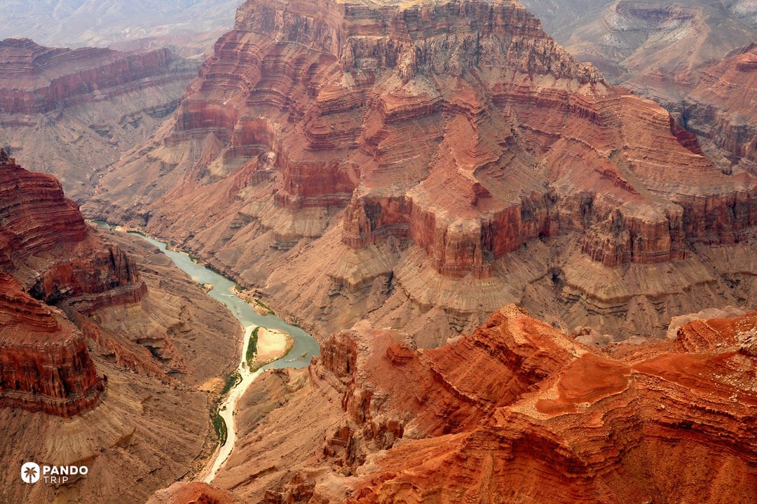
Few places lay geology bare like the Grand Canyon, a vast natural wonder in North America. Layer after layer – Kaibab limestone at the rim, 1.8-billion-year-old Vishnu schist by the river – reveals nearly half of our planet’s timeline in a single panorama. Add 373 bird species and a sweep of life-zones from ponderosa forests to desert scrub, and the canyon earns top marks for Geological & Natural Power.
Visitors also score. A paved Rim Trail strings 13 wheelchair-friendly viewpoints, while inner-canyon trails deliver true wilderness minutes from a snack bar. Sunrise throws lavender shadows across buttes; after dark, the South Rim’s International Dark Sky status lights up the Milky Way instead of parking lots. Infrastructure is world-class, yet step below the rim and you can still walk hours without meeting another hiker.

Signature experience
Two-day rim-to-river trek – South Kaibab down 14.3 km (8.9 miles) to Phantom Ranch, overnight in a stone cabin or tent, Bright Angel up 15.7 km (9.7 miles) at dawn. One route, every geologic era.
Need-to-Know
- Access: South Rim open year-round; North Rim seasonal (May–Oct)
- Entry: $35 per vehicle, valid for 7 days
- Permits: Required for overnight hikes; secure months ahead
- Climate: Extreme heat in summer (40°C/104°F at river), mild on rims (25°C/77°F)
- Viewing: Hopi Point for sunset; Mather Point ideal for sunrise; International Dark Sky Park status offers extraordinary stargazing
- Lodging: Rim hotels (El Tovar, Bright Angel Lodge) book up months ahead; Phantom Ranch via lottery

Score Breakdown:
- Geological & Natural Power (50%): 99/100 – Iconic scale (1.8 km deep, 446 km long), geologic significance globally unparalleled (half Earth’s history on display).
- Experience & Environment (25%): 95/100 – World-class viewpoints, extensive interpretive info, diverse ecosystems; can be crowded at popular spots, but overall visitor experience is superb (well-managed, with chances for solitude on trails)
- Adventure & Accessibility (25%): 98/100 – Offers everything from easy rim walks to extreme backcountry treks and rafting; high accessibility (paved paths, shuttles) yet retains vast wilderness beyond the rim; top-notch safety and infrastructure for a park of its size.
2. Yarlung Tsangpo Grand Canyon, Tibet, China
Total score: 92/100 | Six-kilometre-deep Himalayan gash where jungle meets glacier.

Straddling the Great Bend of the Yarlung Tsangpo (upper Brahmaputra), this gorge plunges as much as 6,009 m (19,714 ft) – more than two Grand Canyons stacked – while snaking for roughly 504 km (313 miles) through the rising Himalaya. The vertical drop forces every climate zone to pile on top of the next: subtropical rainforest thrums with orchids and leeches at 660 m (2,165 ft), while alpine tundra and hanging glaciers rim the skyline near 7,782 m (25,531 ft) Namcha Barwa.
The canyon stayed largely mythic until the 1990s; today it is still wilder than any road. Cataracts thunder unseen in cloud forest, and a newly recorded 102.3 m (336 ft) Himalayan cypress – Asia’s tallest tree – hints at how under-explored the ecosystem remains. Rumblings of a record-breaking hydro-dam remind visitors that this “living laboratory” hangs in the balance.

Signature experience
Multi-day trek from Pai village to the Great Bend viewpoint, contouring under Namcha Barwa’s ice-fluted pyramid, then descending humid switchbacks to Zhongba’s cliff-side hamlets. Prayer flags crack in the wind, waterfalls free-fall hundreds of metres, and at night the only sound is the river’s roar ricocheting off walls five kilometres high.
Need-to-Know
- Access Hub: Fly Lhasa → Nyingchi (3 hr drive to Pai); foreigners need Tibet Travel Permit and local guide.
- Permits: Additional frontier-pass required for border area; organize through registered Tibet agency.
- Season: April-May or Sept-Oct; monsoon (Jun-Aug) brings landslides and cloud-shrouded peaks.
- Altitude range: 660 m (2,165 ft) river to ≥4,000 m (≥13,123 ft) viewpoints – plan staged acclimatisation.
- Logistics: Minimal facilities beyond Nyingchi; homestays or camping necessary; local guides essential for safety

Score Breakdown
- Geological & Natural Power (50%): 100/100 – Earth’s deepest canyon, 6 km (3.7 miles) of vertical relief, fastest geological uplift rates, 3,800+ plant species across 7 vegetation zones, Asia’s tallest tree.
- Experience & Environment (25%): 74/100 – Raw, pristine wilderness but limited infrastructure and frequent weather/landslide challenges.
- Adventure & Accessibility (25%): 94/100 – Extreme-grade trekking and Class V white-water; access still requires permits, guides, and serious logistics.
3. Colca Canyon, Arequipa Region, Peru
Total score: 91/100 | Terraced Andean chasm where condors surf dawn thermals.
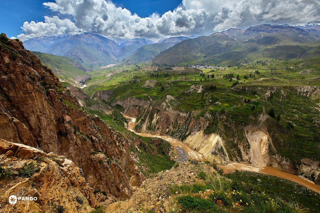
Twice as deep as Arizona’s Grand Canyon, Colca plunges roughly 3,270–3,400 m (10,725–11,155 ft) from rim to river while meandering up to 100 km (62 miles) through volcanic Andes terrain. The Colca River’s 150-million-year carving exposes layered basalt and ignimbrite, then meets human engineering: pre-Inca stone terraces still climb the canyon walls like green contour lines.
Altitude drives variety. High-puna grassland gives way to valley oases where giant hummingbirds flit among cactus flowers. Above the up-drafts, Andean condors – wingspan up to 3.3 m (10.8 ft) – loop effortlessly beside snow-capped volcanoes. Their presence, plus the living patchwork of Collagua and Cabana culture, makes Colca as much about life as geology.

Signature experience
Sunrise at Cruz del Cóndor viewpoint: gather at the rim as first light hits the cliffs and condors rise on warm air columns, sometimes gliding metres overhead with 1,200 m (3,937 ft) of void beneath their wingtips.
Need-to-Know
- Entrance: Boleto Turístico 70 PEN (≈US $18), valid seven days; funds local towns.
- Altitude: Canyon rim sits at 3,200–3,600 m (10,499–11,811 ft); acclimatization recommended to prevent altitude sickness
- Timing: May-November dry season ideal; condor viewing best between 7–9 AM with clear skies
- Accommodation: Family-run lodges in canyon villages; basic facilities but authentic experience

Score Breakdown
- Geological & Natural Power (50%): 95/100 – Exceptional depth (3.4 km/2.1 miles) and geologic significance, among deepest on Earth
- Experience & Environment (25%): 84/100 – Rustic but authentic; breathtaking condor encounters, moderate tourist facilities.
- Adventure & Accessibility (25%): 90/100 – Renowned trekking routes and lookout points; requires some fitness for full experience, but multiple access options (road, mule, etc.).
4. Kali Gandaki Gorge, Mustang & Myagdi Districts, Nepal
Total score: 90/100 | Himalayan trench dropping 5.5 km (3.4 miles) between two 8,000 m (26,247 ft) giants.

Flanked by 8,091 m (26,545 ft) Annapurna I and 8,167 m (26,795 ft) Dhaulagiri, the Kali Gandaki River has sawn a chasm some 5,571 m (18,278 ft) deep – second only to Tibet’s Yarlung Tsangpo by vertical relief – and stretches roughly 120 km (75 miles) down Nepal’s spine. The river cut fast enough to keep pace with Himalayan uplift, exposing marine shales laced with sacred ammonite fossils (shaligram) prized by Hindu pilgrims.
Cultural layers run almost as deep as the rock. Thakali trading villages, Tibetan Buddhist monasteries, and the pilgrimage shrine of Muktinath line a route that has ferried salt and prayer flags for two millennia. Afternoon katabatic winds – clocked at 15-20 m/s (34-45 mph) – whip dust up the “Windy Valley,” while snow leopards, Himalayan tahr, and musk deer roam protected slopes inside the 7,600 km² (2,934 sq mi) Annapurna Conservation Area.

Signature experience
Hike the dawn-lit stretch from Lete to Marpha: watch first light ignite Annapurna’s south face, brave the midday wind tunnel as it howls upriver, then cross the suspension bridge into medieval Kagbeni, peering 400 m (1,312 ft) straight down to the jade-green river that carved it all.
Need-to-know
- Access: Pokhara serves as gateway; fly or drive to Jomsom, then trek 3–5 days through the gorge
- Permits: Annapurna Conservation Area Permit (ACAP) and TIMS card required; independent trekking allowed
- Timing: March-May and September-November for clear skies; monsoon brings landslides, winter closes high passes
- Beds & bites: Teahouses every 5-10 km (3-6 miles) (try Marpha’s apple pie, Kagbeni’s Thakali dal-bhat); power intermittent, cash is king.
- Altitude: Ranges from 1,200 m (3,937 ft) to over 3,800 m (12,467 ft); gradual ascent recommended to prevent altitude sickness
- Weather Pattern: Strong daily winds peak around noon – plan morning hikes and afternoon shelter

Score Breakdown
- Geological & Natural Power (50 %): 98/100 – Among Earth’s deepest gorges with exceptional biodiversity across dramatic elevation zones
- Experience & Environment (25 %): 85/100 – Iconic peaks, living culture, reliable teahouses; dust and new road nibble at wilderness feel.
- Adventure & Accessibility (25 %): 80 / 100 – High adventure balanced by reasonable access via Pokhara; altitude and weather create moderate challenges.
5. Blyde River Canyon, Mpumalanga, South Africa
Total score: 88/100 | Sub-tropical “green canyon” crowned by quartzite ramparts.

Carved into the eastern Drakensberg escarpment, Blyde River Canyon runs 26 km (16 miles) and drops nearly 800 m (2,625 ft) through 200-million-year-old quartzite layers – making it one of Earth’s largest vegetated gorges. Lush afro-montane forest coats the cliffs, harboring 1,000+ plant species and some 600 bird species, while nyala, hippos and the endemic Blyde River protea thrive in the 29,000 ha (71,660 acres) nature reserve cradling the gorge.
Most travellers sample the canyon via the Panorama Route. Here, God’s Window frames the lowveld 900 m (2,953 ft) below, Bourke’s Luck Potholes swirl with sculpted cylinders, and the Three Rondavels – three hulking cones of quartzite – stand sentinel over the emerald ribbon of water far beneath. Mid-gorge, boat cruises slip beneath 200 m (656 ft) high Kadishi Tufa waterfall, second-tallest of its kind worldwide, and reveal sheer green walls alive with vervet chatter.

Signature experience
Self-drive the Panorama Route at dawn: roll from misty Graskop to Three Rondavels, step onto the cantilever deck, and watch morning haze burn off to unveil 800 m (2624 ft) of forest-draped abyss.
Need-to-know
- Access: Five-hour drive from Johannesburg or 1-2 hours from Kruger National Park; roads suitable for any car.
- Fees: Modest conservation fees at main viewpoints; no special permits required
- Timing: May-September dry season offers clearest skies; summer brings afternoon thunderstorms
- Trails: Short loops (e.g., 2 km/1.2 mile Leopard Trail) to full-day hikes; boat cruises depart every 90 min from Swadini Dam
- Crowds: ≈1 million visitors per year, but multiple overlooks disperse traffic; arrive early for parking at God’s Window

Score Breakdown
- Geological & Natural Power (50 %): 90/100 – Ancient quartzite geology with exceptional biodiversity creating Africa’s greenest major canyon.
- Experience & Environment (25 %): 85/100 – Panorama Route viewpoints, lush scenery, moderate crowding.
- Adventure & Accessibility (25 %): 85/100 – Well-signed drives, half-day trails, boat tours; easy reach from major tourism hubs.
6. Tara River Canyon, Montenegro/Bosnia & Herzegovina
Total score: 87/100 | Europe’s deepest limestone fissure, sliced 1.3 km into emerald rock.

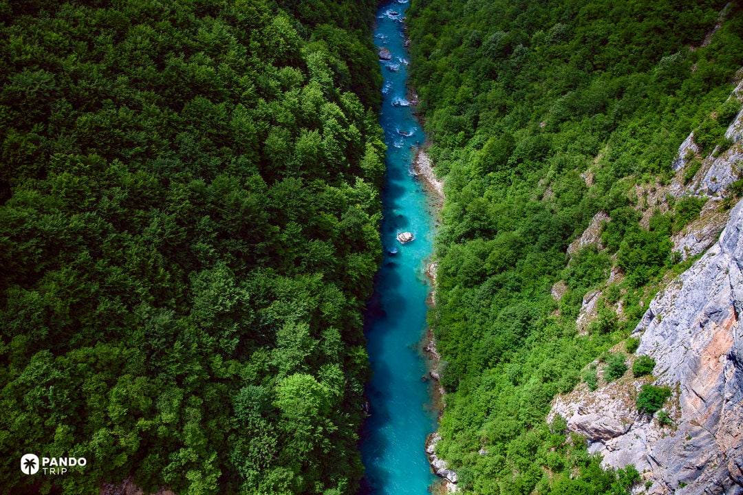
Europe’s wildest gorge drops 1,300 m (4,265 ft) from rim to turquoise ribbon as the Tara River chisels an 82 km (51 mile) corridor between Durmitor’s limestone walls. Mesozoic strata hide 80-plus caves and gush 40 waterfalls into water so pure locals sip it straight – hence the river’s nickname, “Tear of Europe.” UNESCO-listed Durmitor National Park protects black-pine forests, brown bears, and 130+ bird species that cling to the canyon’s ledges.
Yet the scene stays human-scaled: 13th century stone villages perch above sandy banks, and the five-arch Đurđevića Tara Bridge vaults 172 m (564 ft) across the void, framing peaks that spike beyond 2,000 m (6,562 ft). Come at dawn and shafts of light barely graze the canyon floor before noon shadows reclaim it.

Signature experience
White-water raft the upper 18 km (11 miles): punch through spring Class IV rapids beneath 183 m (600 ft) cliffs, pause to glug river-cold water, then drift under Đurđevića Bridge while zip-liners whistle overhead at 121 km/h (75 mph). Landbound? Hike 45 minutes to Ćurevac viewpoint – a 1,625 m (5,331 ft) perch where the canyon plunges, unbroken, to its deepest point.
Need-to-know
- Access hub: Žabljak (2 hr drive from Podgorica / 3 hr from Dubrovnik) offers beds, gear rental, and guides.
- Permits: None for park entry; rafting must be with licensed outfitters.
- Rafting season: May-June snowmelt = wild Class III-IV; July-September mellows to Class II-III (family-friendly).
- Routes: Day trip covers 18 km (11 miles) of biggest rapids; 2–3-day expeditions run full 80 km (50 miles) with riverside camping
- Other thrills: 1,050 m (3,445 ft) zip-line by the bridge; rim trails and steep river-access path near the span.
- Essentials: Water 8-12°C (46-54°F) year-round; outfitters supply wetsuits. Weather shifts fast – carry layers even midsummer.
Score Breakdown
- Geological & Natural Power (50%): 88/100 – Europe’s deepest canyon with exceptional karst formations and pristine aquatic ecosystems
- Experience & Environment (25%): 82/100 – Remote wilderness character with limited crowds outside peak season; basic amenities preserve authenticity
- Adventure & Accessibility (25%): 90/100 – World-class rafting, zipline, rim hikes; mountain roads but clear signage.
7. Cotahuasi Canyon, Arequipa Region, Peru
Total score: 85/100 | Andean abyss 3.5 km (2.2 miles) deep, roaring with Sipia’s 150 m (492 ft) falls.
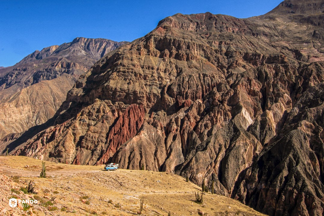
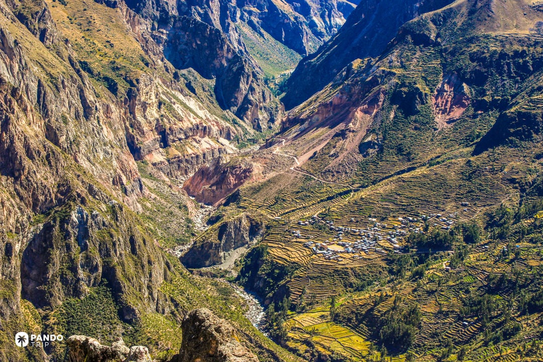
Cutting more than 3,535 m (11,598 ft) below the 6,000 m (19,685 ft) volcanoes Coropuna and Solimana, Cotahuasi may edge out Colca as Earth’s deepest measured canyon. Over roughly 100 km (62 miles) the Cotahuasi River drops from high puna to semi-tropical terraces, watering pre-Inca agriculture and revealing volcanic layers laced with ammonite fossils. Condors spiral on thermals, vicuñas graze the rim, and the torrent duck paddles emerald pools far below.
Few travellers make the 10-hour night bus from Arequipa, so the gorge stays fiercely untamed. Villages like Quechualla press wild-grape wine, while the 150 m (492 ft), rainbow-wreathed Sipia Waterfall thunders in a slot of multicoloured rock. Trekking trails are unmarked mule paths; camp anywhere with permission and wake to Andean silence broken only by river roar and flute-like bird calls.

Signature experience
Hike the 10 km (6.2 mile) trail from Cotahuasi town to Sipia Waterfall: cross the Cuyao hanging bridge, trace terraced slopes where condors cruise overhead, then peer over Sipia’s brink as the river free-falls 150 m (492 ft) into mist and rainbows – cap the day with a soak in Luicho hot springs back in Alca.
Need-to-know
- Access: Overnight bus from Arequipa (10-12 hours) via rough mountain roads crossing 4,500m passes
- Permits: No special permits required; small fees for specific attractions like hot springs
- Accommodation: Basic family-run hostels in Cotahuasi town; camping necessary for deeper exploration
- Infrastructure: Minimal tourism development; unmarked trails require local guidance or strong navigation skills
- Timing: April–November dry season optimal; December–March brings landslides and road closures
- Altitude: Town sits at 2,600 m (8,530 ft); acclimatization in Arequipa recommended before high-altitude bus journey
- Logistics: No ATMs; bring sufficient cash (Peruvian soles); limited cellular coverage beyond town
Score Breakdown
- Geological & Natural Power (50 %): 90/100 – 3.5 km (2.2 mile), volcanic strata, endemic high-Andes fauna.
- Experience & Environment (25 %): 80/100 – Raw, crowd-free culture-nature mix; comfort basic.
- Adventure & Accessibility (25 %): 85/100 – Unmarked treks, wild Class V river, tough access amplifies thrill.
8. Verdon Gorge, Provence-Alpes-Côte d’Azur, France
Total score: 84/100 | Turquoise ribbon of river slashing 700 m (2,297 ft) through Provencal limestone.

The Verdon Gorge – 25 km (15.5 miles) of Cretaceous limestone karst – is Western Europe’s deepest canyon outside the Alps, plunging up to 700 m (2,297 ft). The limestone chasm frames what many consider the most stunning river on Earth, its glacial minerals tinting the water a surreal jade. Its cliffs sit at a climatic crossroads, sheltering 1,500-plus plant species – one-third of all French flora – and hosting reintroduced griffon vultures that wheel on midday thermals.
The Verdon Gorge – 25 km (15.5 miles) of Cretaceous limestone karst – is Western Europe’s deepest canyon outside the Alps, plunging up to 700 m (2,297 ft). The limestone chasm frames what many consider the most stunning river on Earth, its glacial minerals tinting the water a surreal jade. Its cliffs sit at a climatic crossroads, sheltering 1,500-plus plant species – one-third of all French flora – and hosting reintroduced griffon vultures that wheel on midday thermals.
Outdoor culture is just as rich: more than 1,500 bolted climbing routes drape the walls, kayaks slip from Lac de Sainte-Croix into the lower gorge, and Europe’s highest road-legal bungee (182 m/597 ft) sways from Artuby Bridge. Yet the region remains carefully managed inside Verdon Regional Natural Park, where clear signage, shuttles, and rim roads make wild scenery surprisingly accessible.

Signature experience
Start in La Palud-sur-Verdon and trace the vertiginous Route des Crêtes: first lean over the railing at Belvédère de l’Escalès to watch rock-climbers inch across 300 m (984 ft) of orange limestone opposite your perch, then roll onward to Balcon de la Mescla where the canyon yawns 700 m (2,297 ft) beneath your feet in a jade-green hairpin. As evening softens the cliffs, trade wheels for water – slide a kayak from Lac de Sainte-Croix into the lower gorge and paddle through electric-blue reflections as the limestone walls blush pink in the Provencal sunset.
Need-to-know
- Access hub: 2 h drive from Nice or Marseille; narrow, guard-railed roads – drive defensively.
- Fees: No canyon entry charge; parking €3–6 at busy lots, no camping inside the gorge.
- Season: Apr-Jun & Sep-Oct best for hiking/climbing; Jul-Aug brings crowds and rim-road traffic.
- Trails: Sentier Blanc-Martel (16 km/10 miles one-way, 6 h, tunnels – bring headlamp) is the must-do hike.
- On-water: Kayak/SUP rentals near the lake; spring dam-release adds rafting volume upstream.
- Thrills: Europe’s highest bungee jump (182 m/597 ft) operates weekends Apr-Nov – reserve ahead.
- Accommodation: Book early in nearby villages like La Palud-sur-Verdon; two-day minimum recommended for sunrise/sunset experiences

Score Breakdown
- Geological & Natural Power (50 %): 85/100 – Limestone walls, 1 500+ plant species, and a river so arresting it cements Verdon’s reputation as a bucket-list European destination.
- Experience & Environment (25 %): 85/100 – Well-managed park, stunning vistas, busy midsummer.
- Adventure & Accessibility (25 %): 82/100 – Climbing, paddling, bungee, signed roads/trails; vertiginous driving deters some.
9. Copper Canyon, Chihuahua, Mexico
Total score: 84/100 | Six interlaced gorges – one plunging 1.88 km (1.17 miles) – threaded by a cliff-hugging railroad.

Copper Canyon is not a single canyon but a labyrinth of six: Urique, Sinforosa, Batopilas and three smaller sisters slice more than 150 km (93 miles) through a volcanic plateau in the Sierra Tarahumara. Urique Canyon alone drops 1,879 m (6,165 ft) from pine-oak rim to subtropical riverbed – deeper than most of the Grand Canyon’s transects. Lava-forge ignimbrites and basalts stand in sheer walls and knife-edge mesas, while rivers have etched terraces where Rarámuri villages perch in adobe or cave dwellings that feel lifted from another century.
Ecological range is just as outsized: rim forests shelter Mexican spotted owls and hundreds of bird species, then tumble toward canyon floors rich with organ-pipe cacti, palm groves and river otters. Cultural life still pivots on endurance; Rarámuri runners navigate goat-track switchbacks the way their ancestors did, and visitors who follow soon realize why this maze remains Mexico’s quiet giant.

Signature experience
Board the El Chepe Express at Creel and rattle west toward Divisadero: the train clings to cliff faces, dives through 86 tunnels and glides over 39 bridges before stopping so you can step onto the rim where three canyons collide – Urique yawns nearly a mile below and Rarámuri women spread basket wares beside you. Stay to ride the 2.55 km (1.58 mile) Copper Canyon ZipRider in Adventure Park, soaring across the void at up to 135 km/h (84 mph) for a hawk-eye view of the labyrinth.
Need-to-know
- Access hub: El Chepe train runs between Los Mochis and Chihuahua City; key stops Creel, Divisadero, Bahuichivo. Overnight 2–3 nights for rim hikes or 4×4 tours.
- Season: November-February crisp on the rim (snow possible), warm at rivers; June-September rains green the walls and boost waterfalls.
- Permits & fees: No overall park pass; Adventure Park zipline/cable car charge MX$350-MX$1,000.
- Roads: Paved to Creel/Divisadero; beyond that, rough switchbacks – hire guides or 4×4 if descending to Batopilas.
- Altitude: Rim ~2,300 m (~7,546 ft); descend gradually to avoid fatigue.
- Infrastructure: Basic accommodations outside main stops like Divisadero and Creel; local guides recommended for below-rim exploration
- Culture tips: Buy Rarámuri crafts, ask before photos, learn “kórima” (sharing) to break the ice.
- Security: Tour routes are generally safe, but check local advice; travel in daylight on remote roads.

Score Breakdown
- Geological & Natural Power (50%): 90/100 – Vast multi-canyon system with exceptional depth and diverse ecosystems spanning multiple climate zones
- Experience & Environment (25%): 80/100 – Authentic Rarámuri culture, expanding but still rustic facilities.
- Adventure & Accessibility (25%): 75/100 – Scenic railroad, 2.5 km (1.6 mile) zipline, unmarked rim-to-river treks; logistics demand time and local know-how.
10. Fish River Canyon, ǀAi-ǀAis/Richtersveld Park, Namibia
Total score: 83/100 | Africa’s largest trench, 160 km (99 miles) of sandstone looping across the Namib Desert.
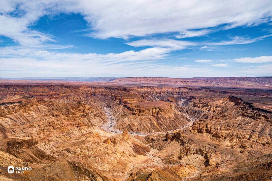
A single glance from Hell’s Bend shows why Fish River Canyon is a desert titan: the river’s serpentine ribbon twists for 160 km (99 miles), drops up to 550 m (1,804 ft), and spans 27 km (17 miles) in the widest bends – dimensions that make it the biggest canyon on the continent and one of Earth’s oldest, its strata dating back 500 million years. Nama sandstone and dolomite ledges glow ochre at sunrise, then fade to mauve under star-laden skies unmarred by light pollution.
Life clings where it can. Quiver trees spear the rim, klipspringers skip along ledges, and mountain zebras nose dry river pools; after rare summer storms the ribbon below swells from a trickle to a torrent. Yet silence rules most days – the canyon lies two day’s drive from Windhoek and sees only a fraction of Namibia’s safari crowds, rewarding those who venture south with raw desert majesty and a sky so dark the Milky Way casts shadows at one of the greatest natural wonders in Africa.

Signature experience
Tackle the 86 km (53 mile) Fish River Canyon hike: scramble down from Hobas into a bowl of fractured sandstone, spend four to five days zig-zagging boulder fields and sandbanks, sleep beside silver pools under Southern Cross constellations, ford the river at dawn fogged with mist, and finish at Ai-Ais to soak trail-sore muscles in geothermal springs before a celebratory Windhoek Lager.
Need-to-know
- Access hub: 8 h drive from Windhoek or 4.5 h from Upington (SA) via the Noordoewer/Vioolsdrif border; nearest town Keetmanshoop (160 km/99 miles away)
- Permits: Park entry fees at gate; advance booking through Namibia Wildlife Resorts essential for hiking. Doctor-signed fitness certificate required for all hikers due to trail’s strenuous nature
- Group Size: Minimum three hikers required; solo or duo hiking prohibited for safety
- Season: Hiking allowed May 1–September 15 only; summer temperatures exceed 40°C (104°F) with flash flood risk
- Logistics: No facilities on trail: carry food, stove, filtration; water found in pools.
- Roadside views: Rim viewpoints near Hobas open sunrise-sunset; gates lock nightly—plan fuel and water.

Score Breakdown:
- Geological & Natural Power (50%): 90/100 – Immense scale with 650+ million-year-old formations in stark desert setting; Africa’s largest canyon
- Experience & Environment (25%): 70/100 – Stark beauty, zero light pollution, but sparse shade and wildlife.
- Adventure & Accessibility (25%): 82/100 – Legendary multi-day hike and hot-spring reward; distant, self-reliant logistics.
Canyon Selection Beyond the Top 10
The canyons that missed our top ten tell their own compelling stories. Consider the paradox of Hells Canyon: at 2,436 meters (7,993 feet), it’s technically North America’s deepest gorge, outplaying even the Grand Canyon. Yet its v-shaped profile, carved by the Snake River between Idaho and Oregon, lacks the theatrical reveal of layered cliff faces. Dense forest softens its walls, and its remote location – no scenic railway, no rim-to-rim highway – kept visitor scores modest. Raw statistics, we learned, don’t guarantee ranking supremacy.

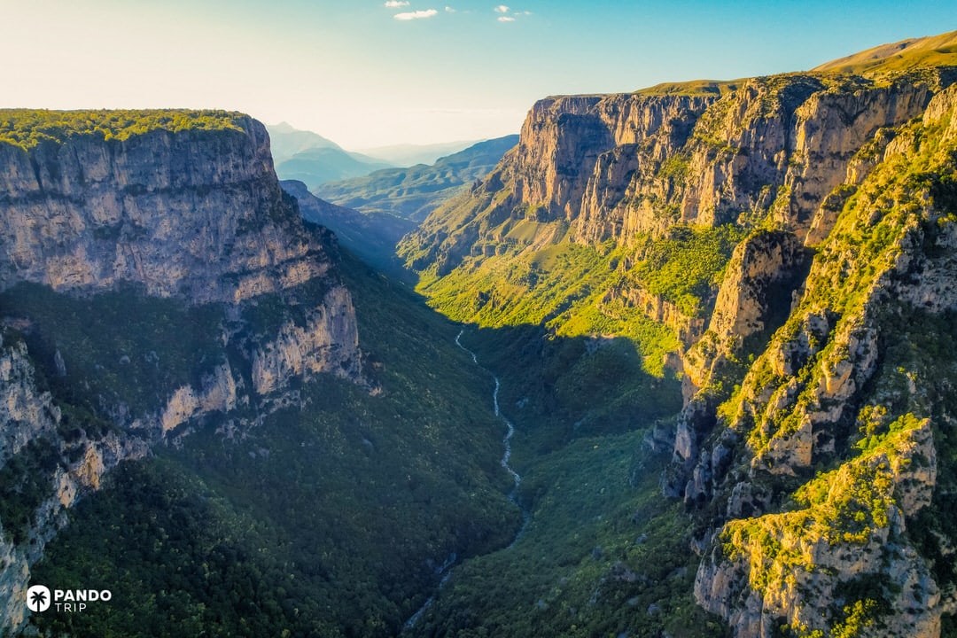
International contenders brought unique calling cards that nearly earned placement. Greece’s Vikos Gorge posted extraordinary proportions – the Guinness Book credits it as Earth’s deepest canyon relative to width – while hosting brown bears and Byzantine monasteries in its Pindus Mountain isolation. Morocco’s Dades Gorge wove cultural richness into its ochre layers, with Berber villages and thousand-year-old kasbahs adding human depth to geological wonder. Brazil’s Itaimbezinho offered something none of our top ten could: the dramatic moment where tropical Atlantic rainforest meets sheer basalt precipice, creating waterfalls that evaporate before reaching bottom. Hawaii’s Waimea presented island-style erosion, its iron-rich volcanic soils painting the “Grand Canyon of the Pacific” in rust and emerald.
Then there’s the question of fame versus scale. Antelope Canyon’s global recognition approaches that of our top-ranked sites, yet its narrow slot measures just 40 meters deep – a geological footnote that happens to channel light like a natural cathedral. Even smaller is The Wave, that phantasmagoric section of Paria Canyon-Vermilion Cliffs Wilderness where ancient sand dunes froze into stone. Limited to 64 visitors daily via lottery, this basketball-court-sized wonder generates desire inversely proportional to its dimensions. Utah’s Zion Canyon rounds out the beauty-over-bulk category: its Virgin River carved modest but perfect proportions, creating a narrow sanctuary where every trail ends at something extraordinary – the Narrows, Angels Landing, the Emerald Pools. These smaller stars prove that in the canyon world, charisma can outweigh pure statistics.
