
Bioluminescent water, an acid-green reef, mudstone badlands, and a bay that runs milk-turquoise over a live volcano.
Taiwan’s strangest sights have one irritating quality in common: they refuse to keep the same calendar. The algae that turns one stretch of the north coast green lasts about seven weeks. The island with the turquoise plume shuts for the winter. There is exactly one month when most of it switches on at once, and, of course, it is also the month with the worst flying weather and the fullest car parks. Start with the water.
Blue Tears, Matsu Islands
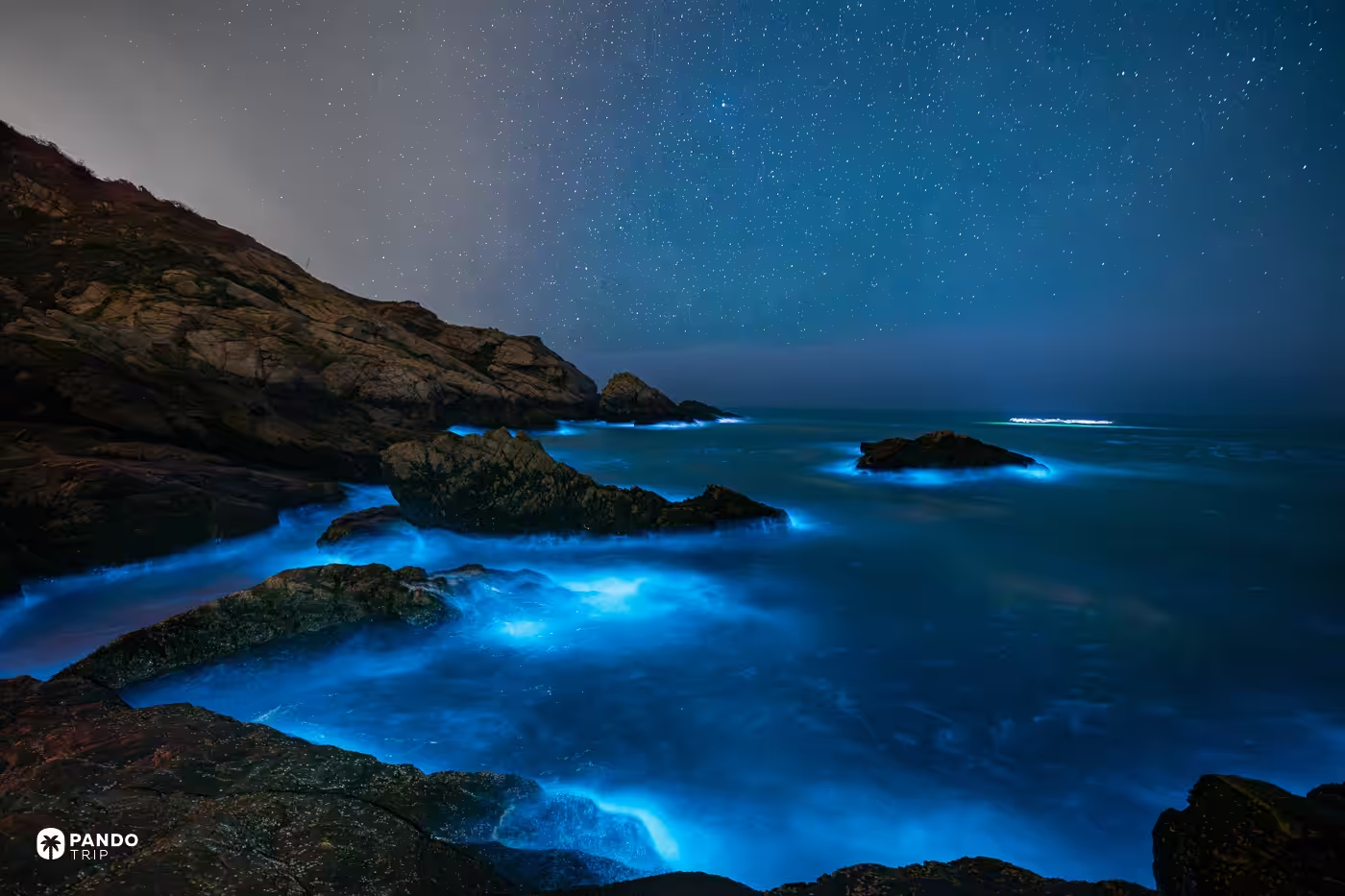
On a good night in the Matsu archipelago the sea does something that looks like a rendering error. A wave breaks and the foam comes up cobalt. The water along a moving hull fills with points of light. The rocks at the tideline are outlined in blue, as if someone had run a highlighter along the coast.
The culprit is Noctiluca scintillans, and there is only one of it — the genus is monotypic, so every bloom in every ocean on earth is the same organism, differing only in whether it carries symbiotic algae inside the cell. The cell itself needs 100× magnification to see. What lights it is mechanical: agitate the water, luciferin meets luciferase, and the whole thing fires. From April to June the Min River runs high and pushes nitrogen, silicon and phosphorus into the strait, feeding the bloom to its peak.
Here is the part the tourist board is quieter about. Chasing the tears on open coast is gambling. You need dark, so go before moonrise or after moonset; you need a rising tide rather than a falling one; and you need a shore facing into the night’s wind. Get one wrong and you spend two hours at a lit viewing point watching the sea be a sea.
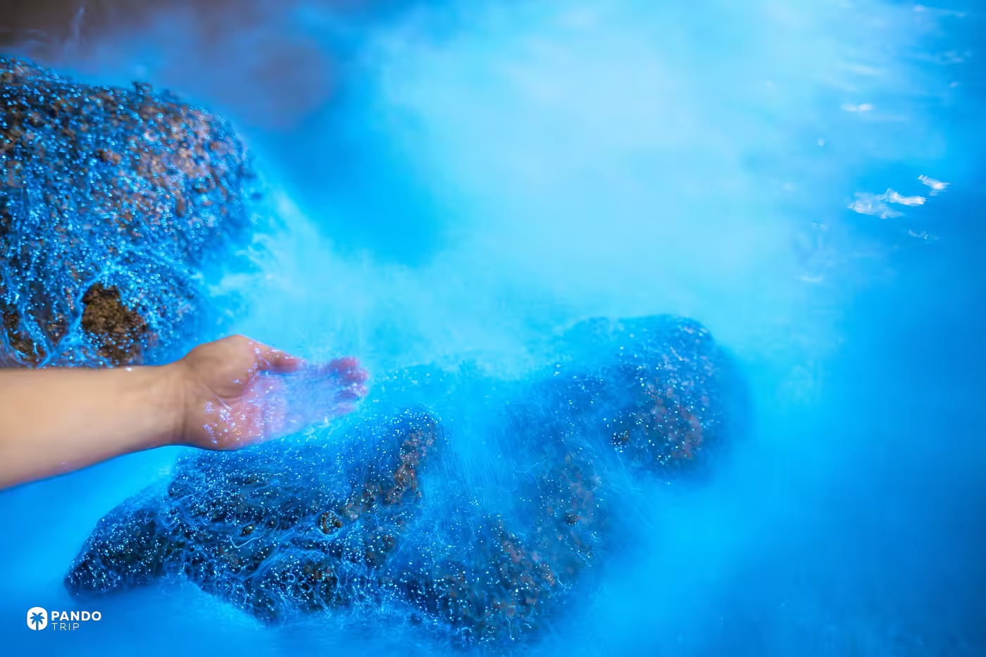
The honest answer, and the one locals call the guaranteed run, is the Beihai Tunnel on Nangan: a Cold War boat pen hacked straight into granite, blacked out, flat as a bath. You sit in a rowboat, stir the water with a ladle, and it lights on demand. Moon and wind become somebody else’s problem. Reservation only, six departures a night through the season, fifteen or twenty minutes on the water. Lienchiang County’s marine education centre keeps the conditions and the safety guidance.
One deflation, because it is true: researchers read a sustained Noctiluca bloom as a eutrophication signal. The prettiest thing in the strait is also, quietly, a readout.
Getting there is the real cost. Matsu’s fog season runs March to June, straight across the good months, and in one documented March week Nangan airport lost twenty-six flights to weather — a 56% cancellation rate. Book afternoon departures rather than dawn ones, keep a spare day, and know that the night ferry from Keelung sails at 22:30 and lands around six in the morning. Sleep at the Mayu Hotel in Ren’ai village, and eat at Yi Ma’s Place, a stone Eastern Min house where the walls are covered in visitors’ handwriting and the pork is cured in rice-wine lees.
Laomei Green Reef, Shimen
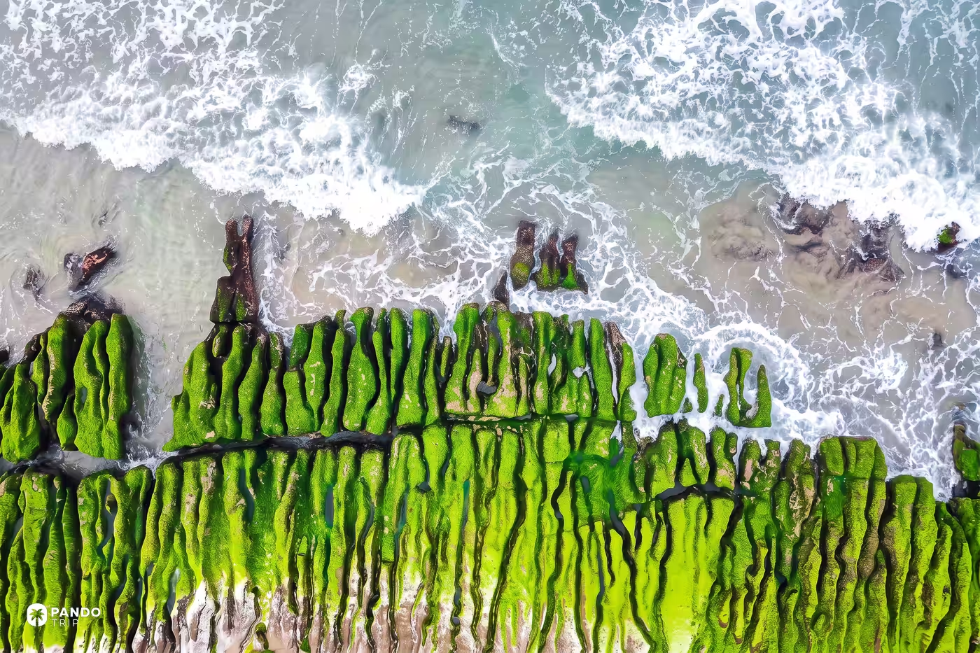
You have about seven weeks. Mid-March to early May, and the narrowest, greenest peak is the first week of April.
For those weeks a two-kilometer shelf of volcanic rock on New Taipei’s north coast turns a green so saturated it looks tinted. The grooves are leftovers of an eruption from the Datun volcanic group: waves chewed out the soft bands and left the hard ones standing, so the shore is combed into parallel ridges running out into the surf. The green filling them is algae, three species of it, sea lettuce among them. It seeds and grows through the winter monsoon and burns off as the sun strengthens, which means the thing you photograph in April was grown in January, by weather nobody visits for.
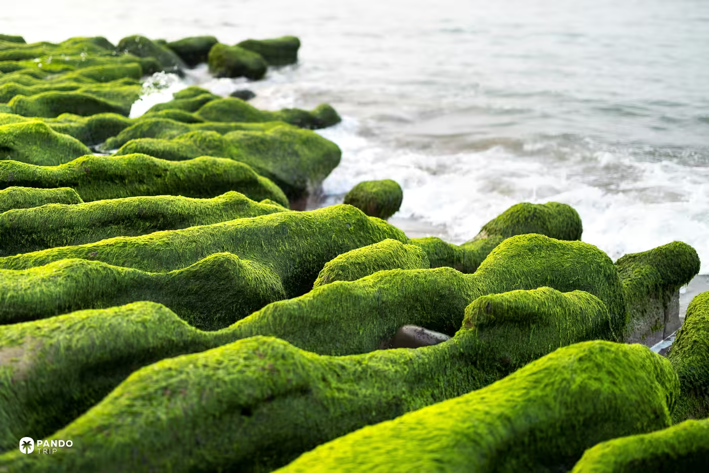
The reef underneath is stranger than the color. Each generation of algae dies, its remains harden into a thin calcareous film, and the next generation grips onto the corpse of the last. The green is the newest layer on a very tall pile of the dead.
Time it to low tide, checking the tide table for Shimen rather than for Taipei, and go early or late for raking light. Then keep off it. The New Taipei City government’s own page carries both warnings: walking on the reef destroys the growing environment, and the algae is slippery enough that people go down hard on wet volcanic rock. Admire it from the sand, which is where the official advice puts you. A top-down photograph is not an invitation.
Guishan Island Milk Sea, Yilan
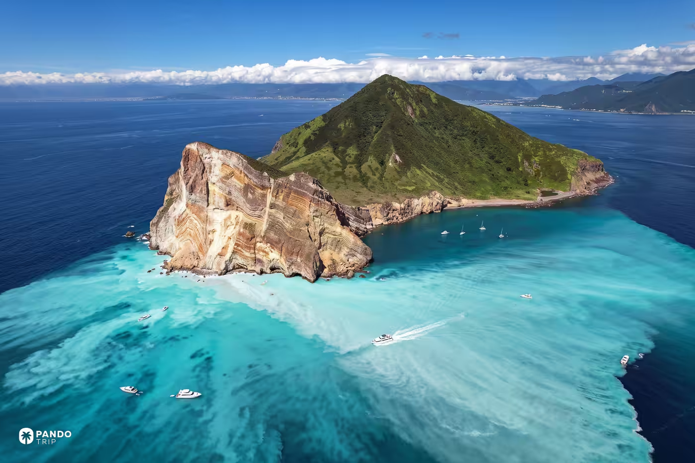
Normal seawater runs about pH 8. The water off the head of Guishan Island measures about pH 6, and it is the color of milk poured into a swimming pool.
Fifty-odd hydrothermal vents lie in ten to eighty meters of water below it, venting at around 110°C with a pH as low as 1.5 — acid hot springs on the seabed. The plume is buoyant, so instead of mixing down it spreads and floats, which is why the effect is a skin on the sea with a hard visible edge rather than a cloudy column. Guishan is not a spent thing, either: at least four eruptions in the past 7,000 years, still classed as active, still exhaling sulfur. The milk sea has no season. It is running right now. What is seasonal is your ability to get a boat onto it.
Which brings us to the paperwork, and here the paperwork is the story. The island opens on 1 March and closes on 30 November, with December, January and February shut outright. Landing is by online application through the Northeast Coast National Scenic Area Administration, between twenty and three days ahead, capped at 1,800 people a day across four slots of 450. The fee is NT$100. Wednesdays in the season belong to academic institutions, so a Wednesday is simply not available to you. And the walk up to the 401 Heights is a separate, much smaller lottery: a hundred people a day, mornings only. It is called the 401 because the summit is 398 meters and someone built a three-meter platform on top of it.
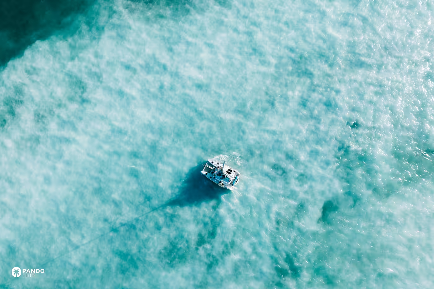
Four products get sold under one island’s name — the circle-island cruise, the landing tour, the 401 climb, and paddling a board into the plume itself — and the differences matter more than the brochures suggest. Skip the cruise. It is the one that needs no permit precisely because it never lands, and you will have come a long way to look at a volcano from a moving deck. Whichever you book, check the administration’s wave board on the morning itself. Boats here are cancelled on sea state, not on ticket sales.
Alishan Sea of Clouds, via the Eryanping Trail
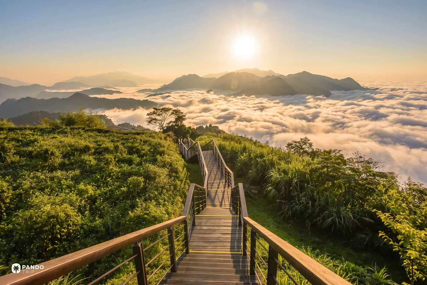
Everyone books the sunrise. The cloud does not care.
Alishan’s famous dawn train climbs to Zhushan, inside the national forest recreation area, on its own ticket. It is a fine thing, and it is not where this view lives. The sea of clouds is an afternoon-into-evening phenomenon, and the scenic-area administration sells the Eryanping Trail on its sunset. Taiwanese cloud-chasers put the dusk cloud layer at roughly 1,800 to 2,000 meters; the trail runs between 1,200 and 1,450. The cloud ends up over your head and spilling toward you, which is a wholly different picture from looking down on a white floor.
Locals don’t frame it as one attraction. The set is called the three treasures of Xiding — the tea terraces, the cloud waterfall, and the Eryanping sunset — and chasing only the cloud collects a third of what you drove up for. You also don’t have to earn it. The first viewing platform is about fifteen minutes from a roadside car park on Highway 18, and the administration has hung 24-hour cameras on the trail so you can look at the cloud and the light before committing to the drive. That is the single most useful thing on this list.
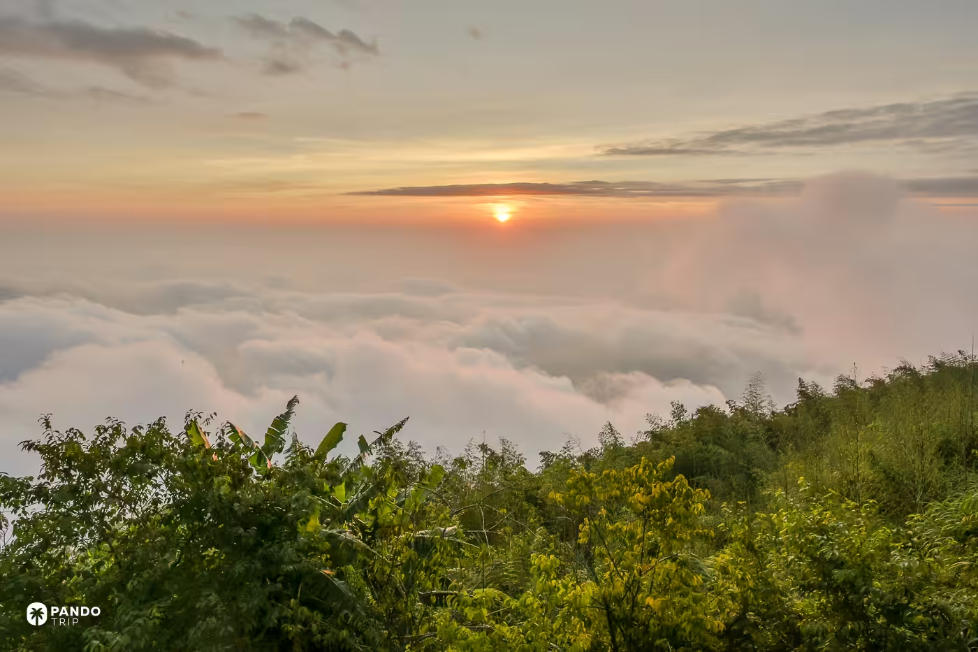
The railway is finally possible again, too. The full Chiayi–Alishan main line reopened in July 2024 after fifteen years out, wrecked by Typhoon Morakot across 421 separate disaster sites. Two trains a day, bookings fourteen days ahead, and since March 2026 you pay the moment you reserve. Popular dates evaporate within hours.
Be honest with yourself about the month, though. The administration’s own answer on when to come for the cloud sea is autumn and winter; Taiwanese cloud-watchers narrow it to December and January. Come in the first week of April and you get cherry blossom instead, 31 varieties of it, plus a timed cordon on Highway 18 and a shuttle up from a service area. Arrive later in the month and you have missed both. Lovely. Just not what you came for.
Penghu Basalt Columns
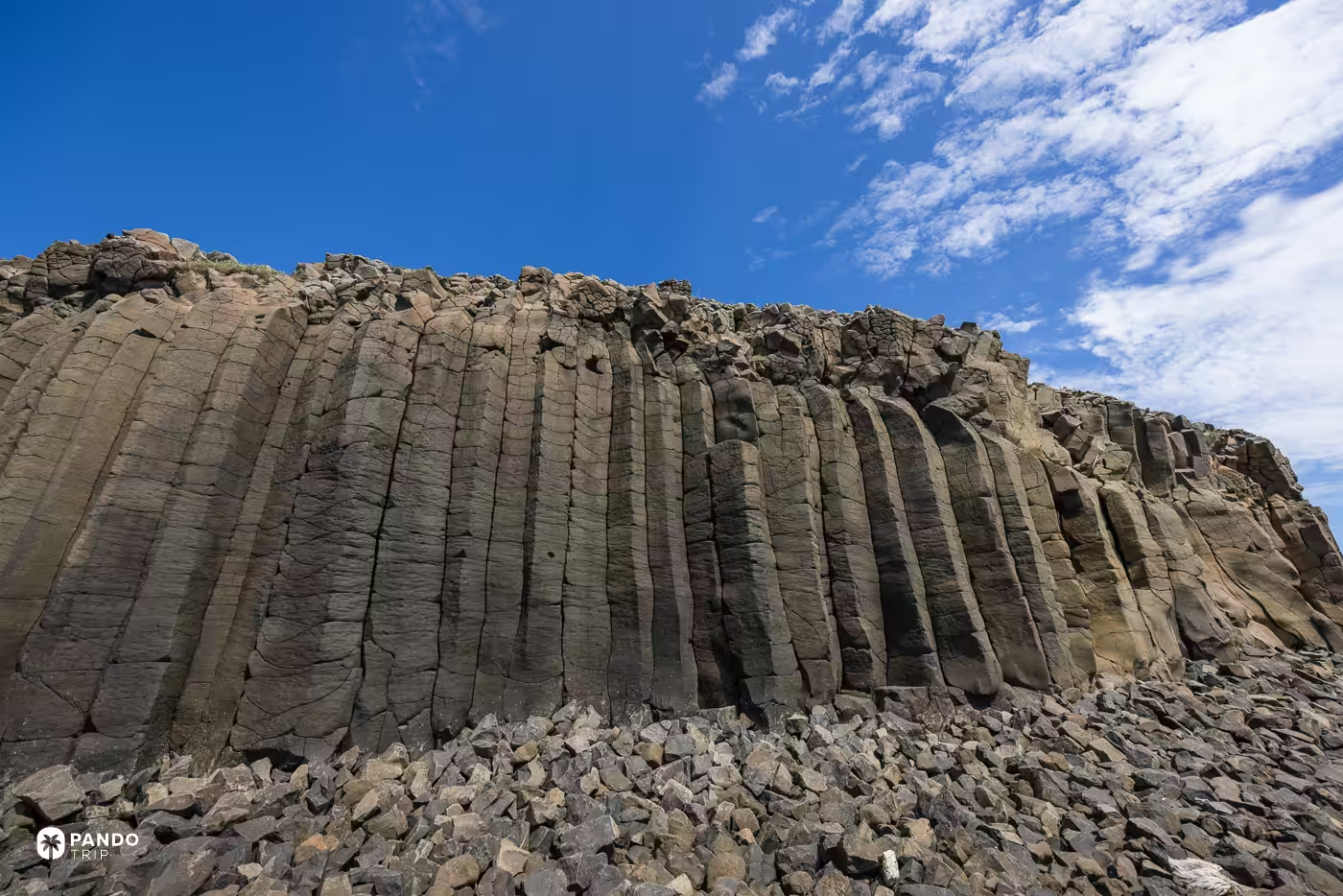
The columns on Tongpan stand in a row like organ pipes abandoned mid-build, twenty meters tall and about a meter and a half across, oxidized at the crown to the color of weak tea. Differential weathering has punched their faces into a honeycomb of hollows that islanders call cat rock.
Now the number that makes them monumental: across all ninety-odd islands of the Penghu archipelago, the highest point of land is 79 meters. The islet itself is a textbook basalt mesa ringed by its own colonnade, which is why the tourism administration has been calling it Penghu’s Yellowstone for years and getting away with it. The rock runs from about 18 million years old down to 8.
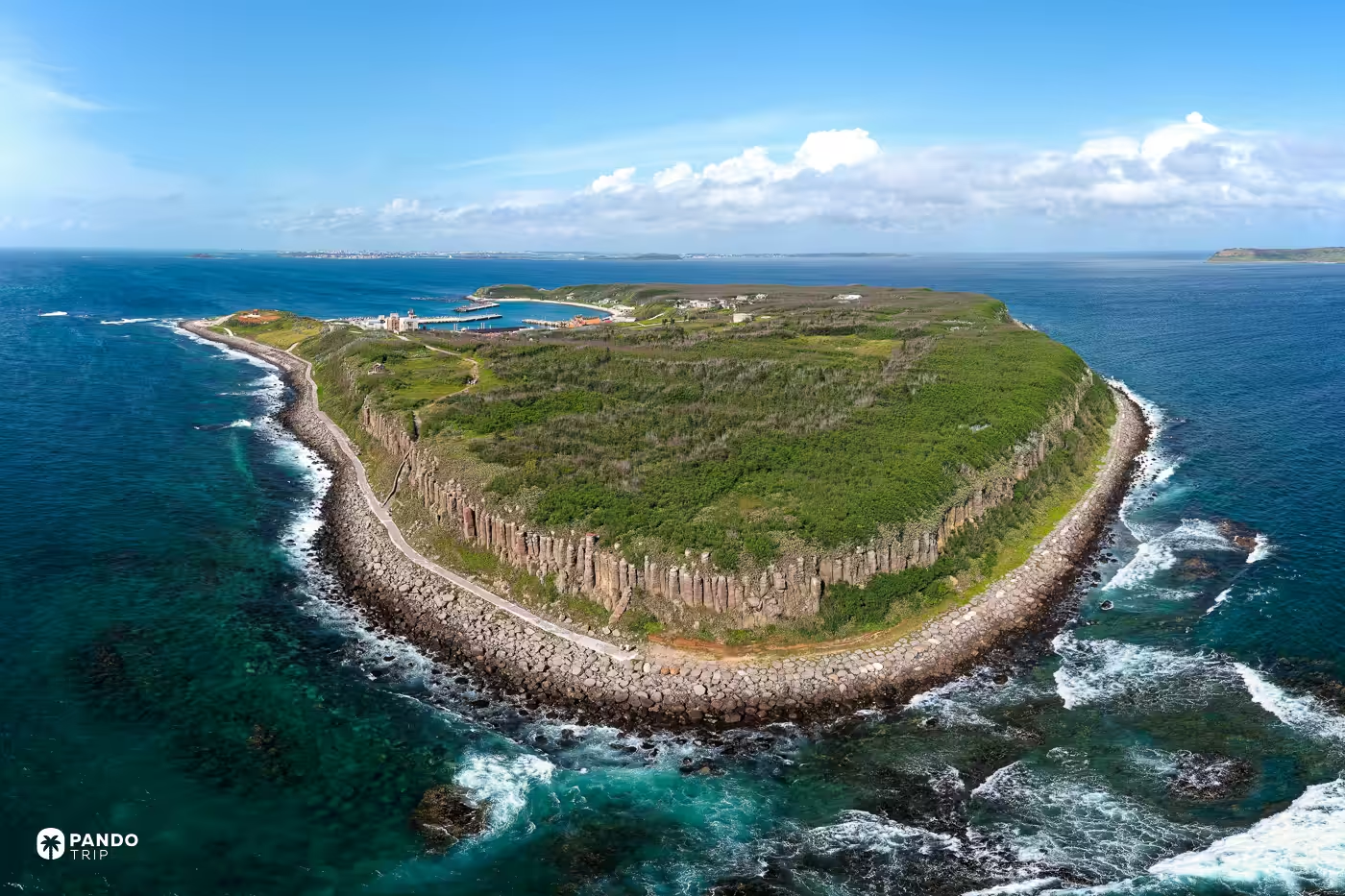
Getting there is a timetable exercise. Scheduled South Sea ferries run from Magong to Tongpan for NT$120 and the crossing is under half an hour, but there are only a handful of sailings a day on a schedule that shifts with season and weather, so phone the South Sea Visitor Centre on 06-9264738 before you plan around it. Penghu’s public ferries also suspend on hard sea-state numbers — waves over three meters or wind over 15.6 meters per second on the Magong–Wangan–Qimei run — and the captain can call it off on his own reading of the sea besides. From October to March the northeast monsoon shuts most of this down. Base yourself at the Discovery Hotel in Magong, three hundred meters from the South Sea wharf, and eat at Rui Feng Seafood, or find the prickly-pear ice sold under the great banyan at Tongliang: magenta, faintly medicinal, and the correct thing to eat on a basalt island in May.
The most photogenic basalt in Penghu, meanwhile, is the one you are legally barred from reaching. Xiji’s Blue Cave, which locals call the stove mouth, sits inside a county nature reserve on an island whose village was moved off in 1978, with no pier and complicated currents. Entering without permission costs NT$30,000 a head.
Golden Waterfall, Jinguashi
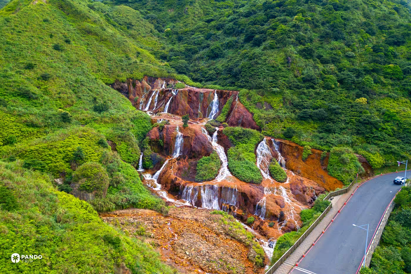
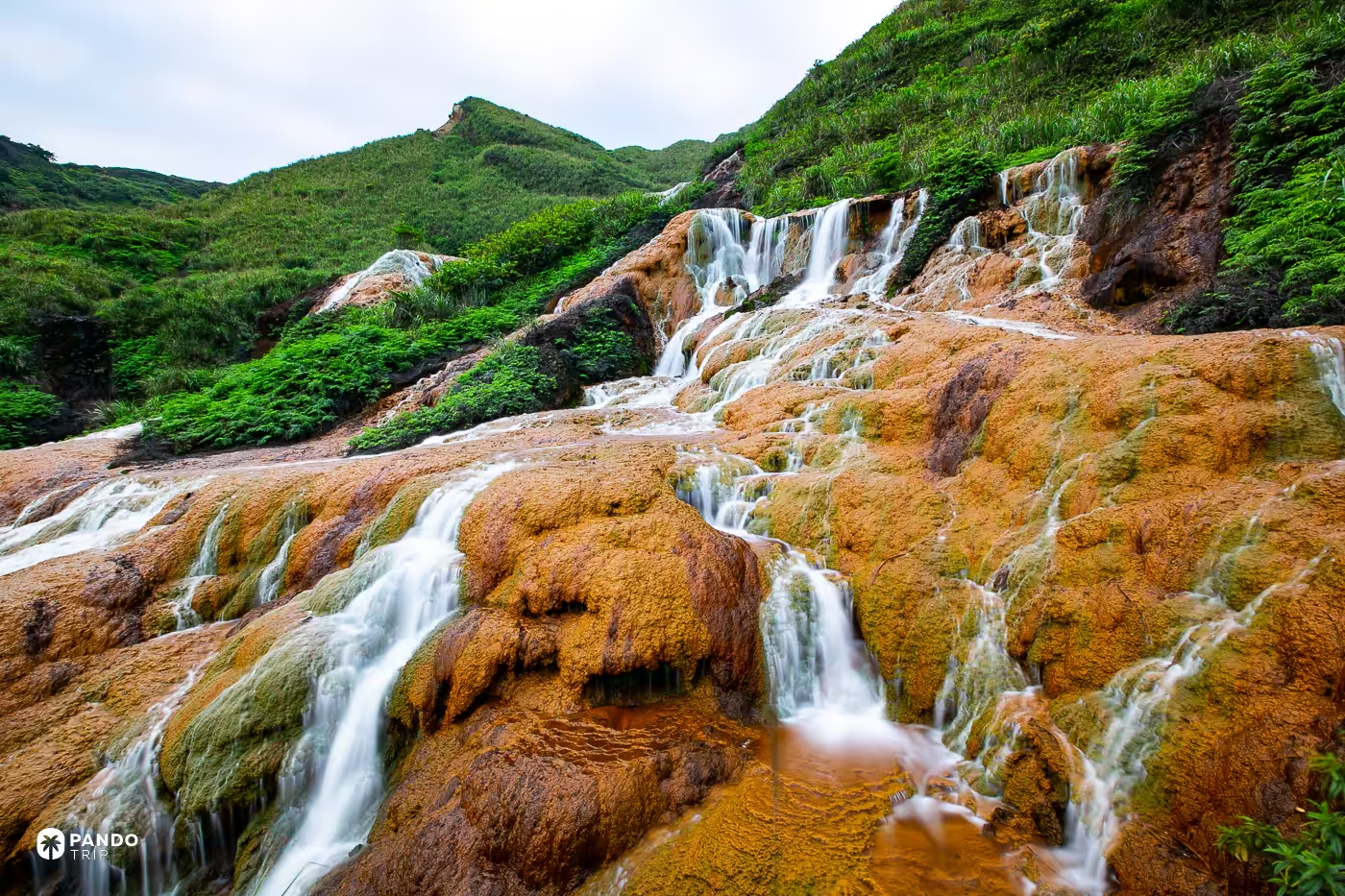
It isn’t gold. It’s rust, and the chemistry has names.
The ore body under Jinguashi is full of iron sulfides, pyrite mostly, with enargite alongside it, and Jinguashi gets a great deal of rain. Groundwater dissolves the sulfides; oxidizing pyrite dumps iron, sulfate and hydrogen ions into the drainage; where that water surfaces and meets air, it lays iron oxide over everything it touches. What you get is an entire hillside glazed the color of a wet terracotta pot, with white water running down the middle of it.
Do not touch it. Taiwanese guides are unusually direct on this point: the water is strongly acidic, and the catchment carries a mining-era legacy of arsenic and heavy metals. Look, photograph, keep your hands in your pockets.
Give it twenty minutes rather than an afternoon, then go a few minutes downhill for the better half of the trip. The Yin Yang Sea is a three-meter-deep illusion. Iron carried down the creek is colorless in fresh water, oxidizes into hydroxide floc when it hits the sea, and floats, because the floc is less dense than seawater and the bay’s circulation is too weak to disperse it. The top three meters are ochre. Everything below is ordinary blue. Above it stands the Shuinandong ore-dressing plant, built in 1933 and shut in 1987, thirteen concrete terraces stepping down a mountain like something abandoned by a civilization with better funding. Buy a miner’s pork-chop lunchbox at the Gold Museum in the afternoon, then come back at six, when Taipower lights the whole thing amber.
Tianliao Moon World, Kaohsiung
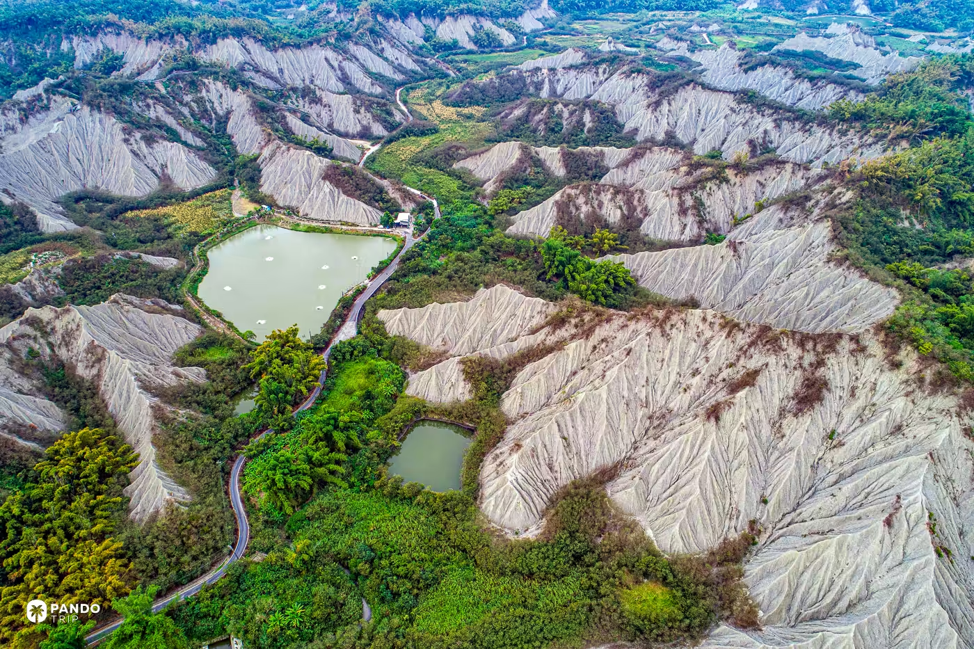
The valley at Tianliao reads like a seabed stood on its side and left out in the weather: knife-edge ridges, fluted gullies, grey rock with nothing growing on any of it, and a couple of improbably green ponds at the bottom.
There is a reason nothing grows. The rock is the Gutingkeng Formation, Pliocene to Pleistocene mudstone laid down in a foreland basin from about five million years ago, when Taiwan’s east rose fast and its west sagged into semi-deep water — the foraminifera and shell fossils in the mudstone are the receipt. It was never buried deep enough to compress properly, so it is structurally weak, and rain strips it faster than any plant can get a grip. The badlands run about thirty kilometers north to south, averaging eight across, from Yujing down to Yanchao.
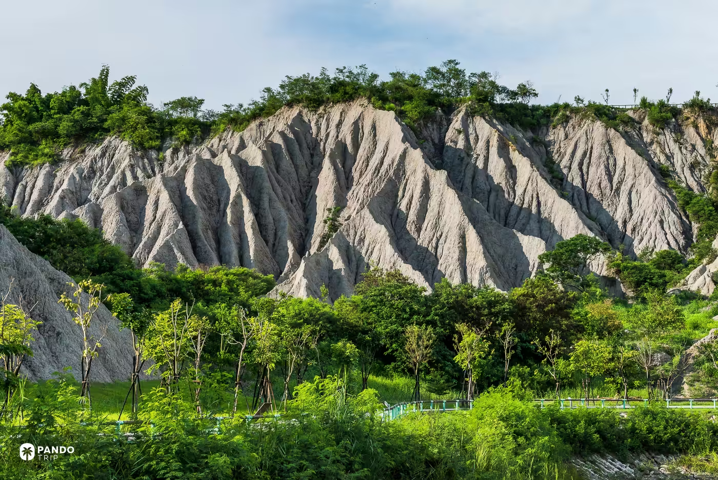
The park is free and open around the clock, floodlit from 18:00 to 22:00. Walk the 800-meter lake loop and then the 600-meter badland trail, and come at either end of the day; at noon the grey flattens out completely and there is no shade anywhere in a treeless valley.
Twenty minutes away in Yanchao is the part most visitors miss. Wushanding holds Taiwan’s largest and best-developed field of cone-type mud volcanoes inside just under four hectares, the country’s second-smallest nature reserve. The cones are perfect here for a mundane reason: the mud arrives with exactly the right water content to hold a shape, and any wetter it would spread into a puddle. Register at the station when you arrive.
Then eat what this landscape invented. The badland belt is thick with hill-chicken houses because the soil grows nothing else, and the ones clustered at the Moon World entrance on Highway 28 will sell you a free-range bird packed in mud dredged from the mud volcanoes and baked for three hours.
Qingshui Cliffs, Hualien
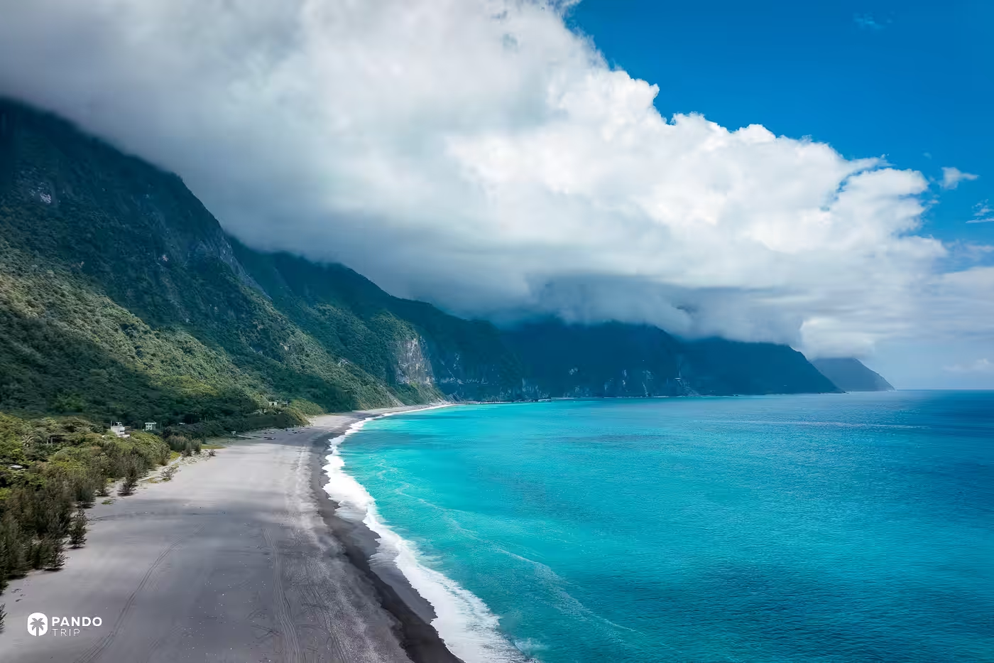
Watch the cloud rather than the cliff. On the right morning a marine air mass comes in off the Pacific, hits the wall, and cannot get over it, so it piles up along the ridge line and then spills across the top in slow motion.
The wall is worth its numbers. Hualien County gives it 22.7 kilometers of coastline and a height of over 800 meters. You will see 1,000 quoted, and even a claim about this being the world’s second-largest cliff, which appears on no official page anywhere. Take the county’s figure and add the one that actually explains the cloud: Qingshui Mountain stands 2,408 meters directly behind it, straight up out of the ocean. Marble, gneiss and green schist, which is why rock this hard can stand this close to vertical, and why an air mass arriving from the east simply stops.
You can drive to it. The main platform sits at the mouth of the Chongde Tunnel at the 176.4K marker, and the rest area there reopened in July 2025 after more than a year of rebuilding. There are two viewing platforms; most people find the first and never look for the second. The improved Suhua Highway now bypasses much of this coastline in tunnel, so drivers on the fast road never see the cliff at all. You have to want it. Stop at Xincheng on the way past for a glass of lemon juice at Jiaxing, a sixty-year-old shop whose entire reputation rests on it.
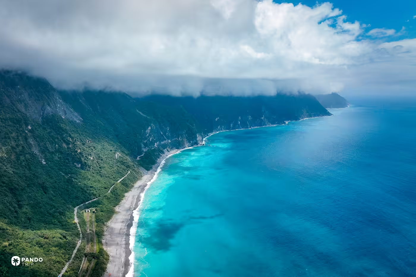
Be realistic about the corridor. This is one of Taiwan’s most landslide-prone highway stretches, and the 2024 earthquake that closed most of Taroko Gorge’s famous trails closed Chongde for over a year; the old Suhua’s Heren–Daqingshui section, 64K to 69K, was written off entirely and formally decommissioned in January 2026. Check road status before committing a day to it. If you want the view from sea level, sunrise kayak trips launch from Chongde beach between April and October, and can be called off before launch or turned back mid-paddle if the sea gets up.
Get the morning right, though, and you will watch a cloud pour over a two-thousand-meter ridge and come apart on the way down.
Yehliu Geopark, Wanli
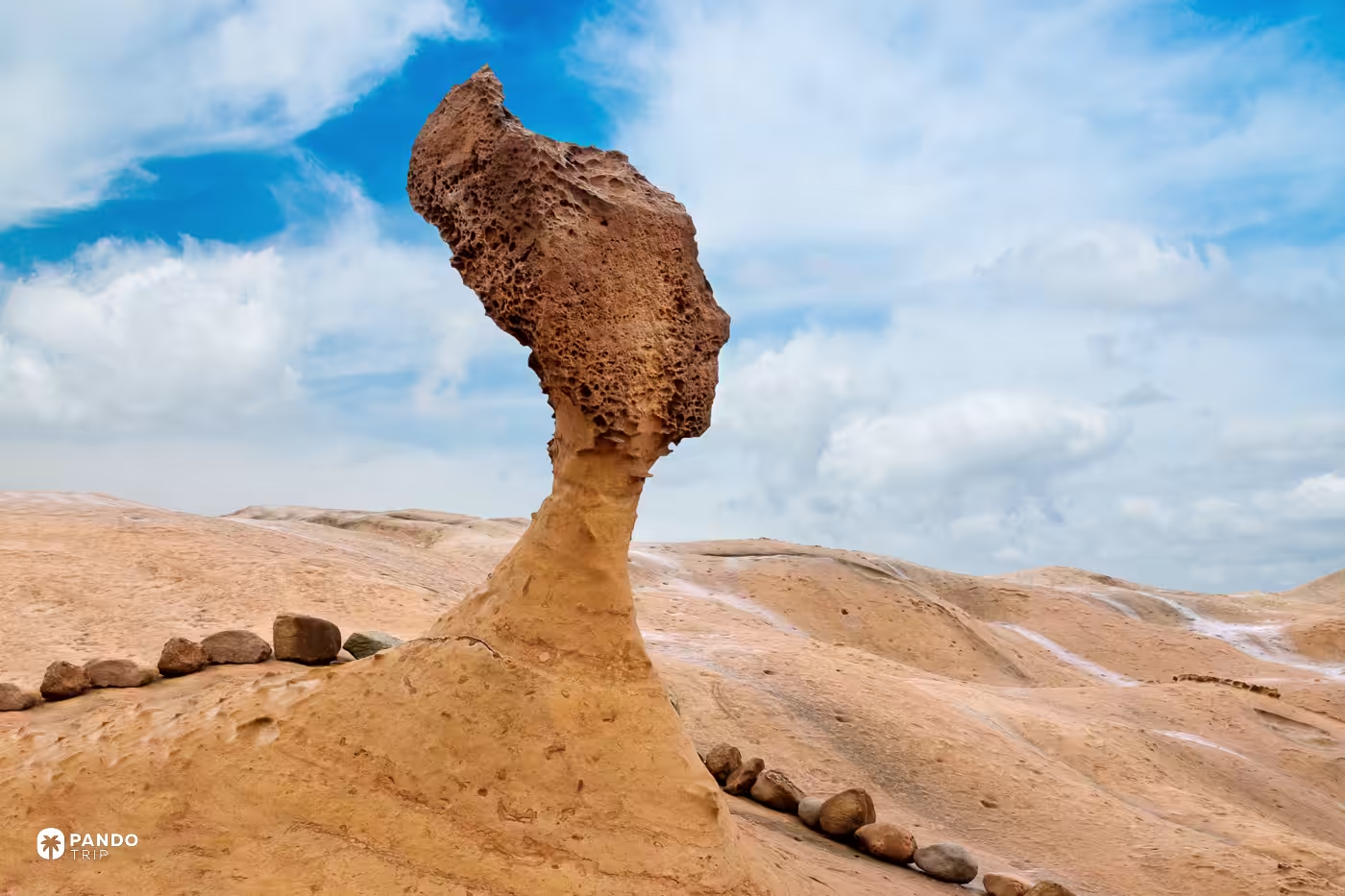
220 centimeters of neck circumference in 1994. 116.59 centimeters at the most recent published measurement, taken in October 2024. The Queen’s Head has lost 103.41 centimeters of neck in thirty-one years, and Yehliu Geopark’s own general manager puts the current rate at one to two centimeters a year.
Nobody is propping her up, and that is a decision rather than an oversight. Stone and chemical consolidants expand at different rates, so as National Taiwan University’s Lin Jun-chuan argues, artificial reinforcement always fails eventually — you would be buying years and guaranteeing a worse ending. The management response is behavioral: barriers, staff, hands off. Comparable mushroom rocks in the park have snapped at around twenty-odd centimeters of neck, and the realistic threat is not another patient decade of weathering but a single earthquake or a typhoon swell.
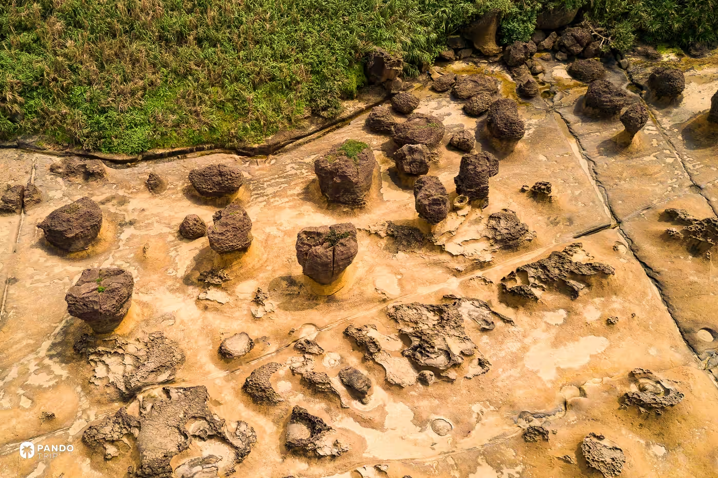
The rest of the park deserves more attention than it gets, partly because most of it is off-limits: about 80% of Yehliu’s area is a closed ecological preservation zone, and the mushroom rocks everyone queues for occupy the minority of the site. Seen from directly above, that field of rocks reads less like geology than like a colony of something — hundreds of dark caps on chalky stalks, spaced as though competing for light.
Now the honest part, because photographs lie about this place by omission. Yehliu takes more than 2.5 million visitors a year by the north-coast administration’s own count, and more than 80% of them arrive with a tour group, which means the crush does not spread through the day. It arrives in waves, at 09:30 to 11:00 and again at 13:30 to 15:00. There is a traffic-light capacity system, and above 3,000 people on site the park stops admitting anyone at all. Peak season is March to May. An empty frame at the Queen’s Head is achievable at 08:00 opening and essentially nowhere else, so treat that hour as the whole plan. April to June and September also open the Queen’s Secret Garden by advance reservation, though only for parties of twenty or more, so it is a group’s reward rather than a solo one.
The succession, meanwhile, is already underway in public. The park’s night event, an annual fixture from late June to mid-July, ran in 2026 on the theme of two queens: a smaller rock called the Cute Princess was given her own gallery and her own projection show. They are training a replacement.
Beitou Thermal Valley, Taipei
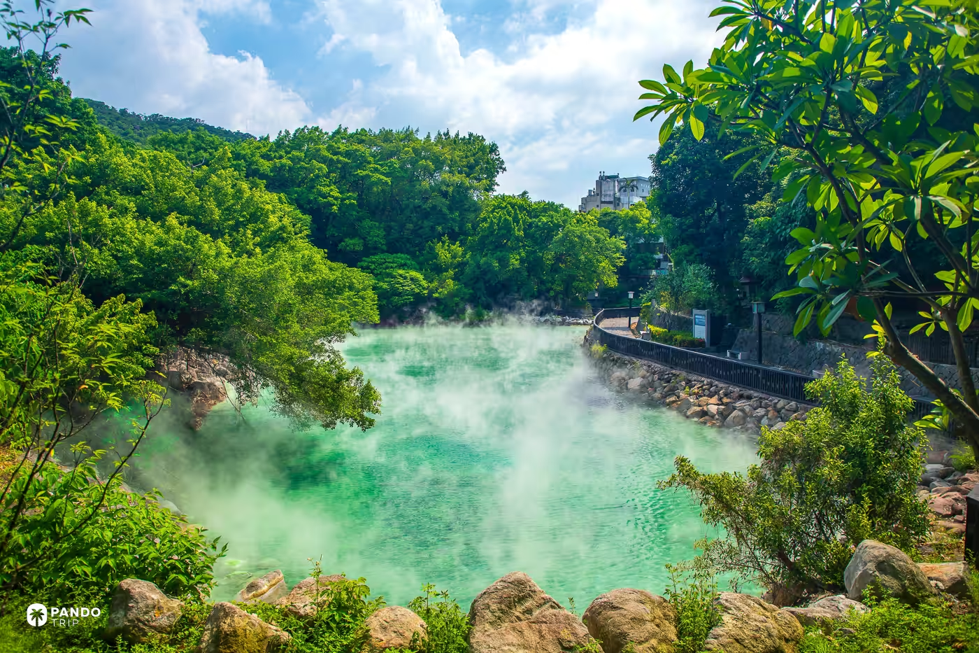
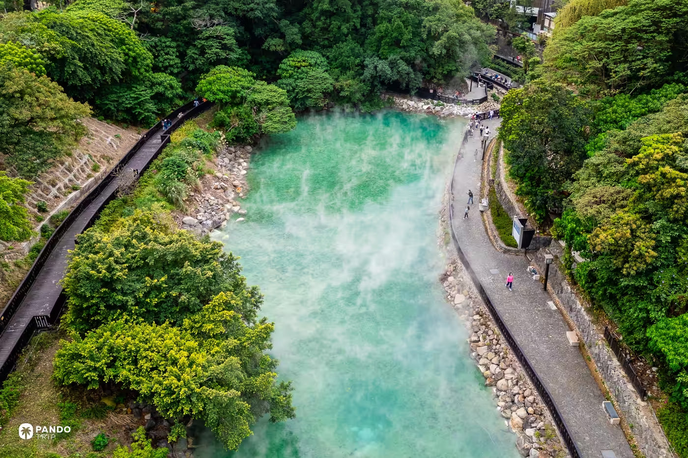
Fifteen minutes’ walk from an MRT station, in an ordinary residential pocket of Taipei, a hollow full of water sits at 90 to 100°C and a pH of about 1.6 — acidic enough to eat metal, undrinkable, and called Hell Valley long before anyone built a boardwalk around it. Come on a cold morning. The jade green is paler in life than in photographs, so the steam is the real show, and cool air does more for you than sunshine. It is free, and shut on Mondays.
The creek draining this hollow grows a mineral called hokutolite, a radium-bearing variety of baryte, and it grows in exactly two places on earth: here, and the Tamagawa hot spring in Akita. Of the several thousand minerals known to science it is the only one named after a place in Taiwan; it was christened in St Petersburg in 1912; it has been a Special Natural Monument in Japan since 1952; and 0.2 hectares of Beitou Creek has been fenced as a nature reserve since 2013, with fines starting at NT$30,000 for walking in. You cannot see it. What you can see is an 800-kilogram lump of it on the ground floor of the Beitou Hot Spring Museum, five minutes away.
Where to base yourself
Five beds cover eight of the ten. Matsu and Penghu have their own, named above.
Taipei — Kimpton Da An, for Laomei, the Golden Waterfall, Yehliu and Beitou, all of which are day trips from the city, Beitou by MRT in well under an hour. Rooftop terrace, a modern-British dining room downstairs, and pets are welcome.
Yilan — Tou-Cheng Leisure Farm, 120 hectares of it, working since 1979; or the OA Hotel at Wushih Marina, two minutes’ walk from Waiao Beach, if you want to be nearer the boats.
Hualien — Kindness Hotel, Hualien Main Station, a six-minute walk from Hualien Station, which is the staging post for the run north to Chongde.
Chiayi / Alishan — the Alishan Hotel, whose historic wing was built in 1913 as the Alishan Forestry Club, entirely in Alishan cypress, and has doubled since 2018 as the highest-altitude local museum in Taiwan. You cannot drive in; the property sits inside the forest control area and runs its own shuttle.
Kaohsiung — Hotel Dùa, next to an MRT entrance and about forty minutes from the badlands.
Which leaves the calendar. If you want the glowing water, the green reef and an open Guishan Island in a single trip, April is the only month that gives you all three — and you should go in knowing it is also Matsu’s foggiest month, Yehliu’s busiest, and the wrong half of the year for Alishan’s clouds. Come back in December for those. Nobody said the strange things would be convenient.