When we wrote an article about the world’s most beautiful rivers, we ended up having a whole debate about what actually makes a river different from a creek. Since we’re all from different countries, our ideas of what qualifies were pretty varied. This seemingly simple discussion hooked us so much that we started digging deeper into it. Eventually, we got so absorbed that this article about the world’s most famous creeks was born.
The Differences Between a River and a Creek
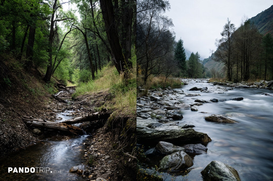
Both creeks (sometimes called a “stream” or “brook”) and rivers are natural flowing bodies of water, but they differ in a few key aspects. The most notable difference is size and water volume. Rivers are generally longer, deeper, and have a much faster water flow compared to creeks.
Another distinction is their relationship with tributaries. Rivers typically have many tributaries flowing into them, whereas creeks usually don’t – creeks themselves are often tributaries of larger rivers. Think of it like a waterway family tree: creeks are the smaller branches that eventually feed into the larger “parent” rivers.
While these definitions provide a general understanding, it’s important to note that there’s no strict scientific line separating rivers from creeks. The distinctions are often subjective and influenced by local usage, historical context, and regional geography. For example, in some parts of the world, what’s called a creek might be larger than rivers elsewhere. Similarly, some well-known creeks have grown into larger bodies of water that could technically be classified as rivers but have retained their historical names as creeks. This shows that the names given by people don’t always perfectly align with geological classifications.
Ultimately, while the definitions may not always be precise, understanding the differences between creeks and rivers helps us appreciate the complex network of waterways that shape our landscapes and have influenced human settlement patterns throughout history – regardless of their size. Let’s take a closer look at some famous creeks around the world.
Havasu Creek, USA

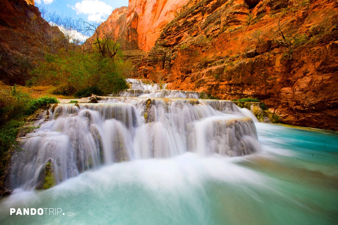
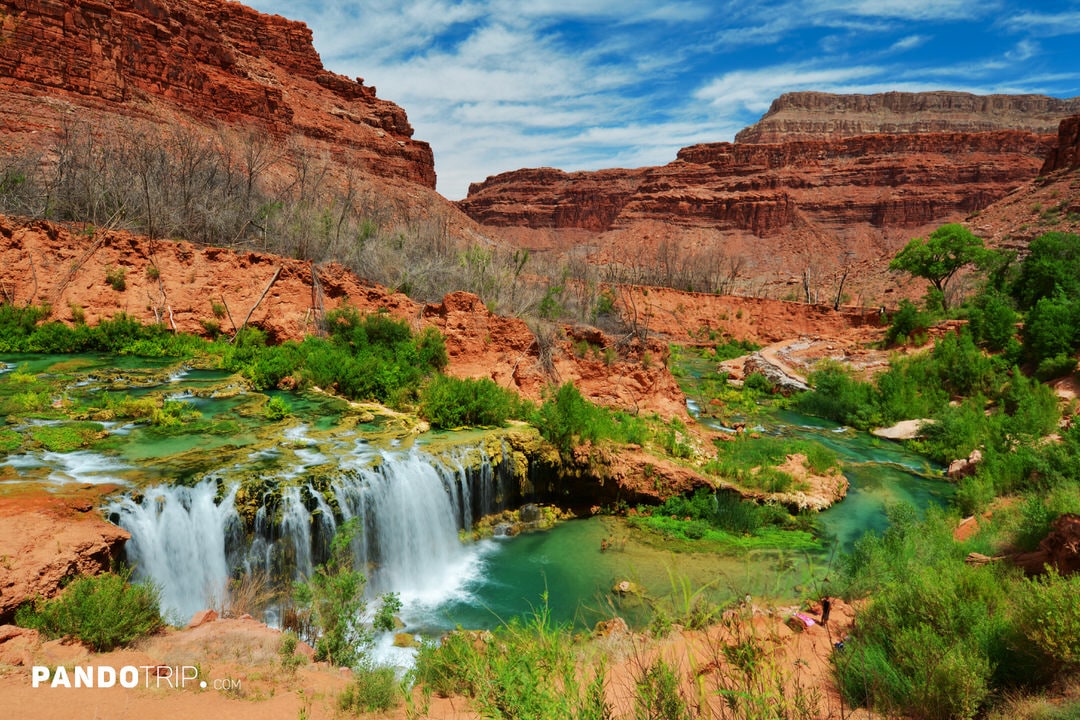
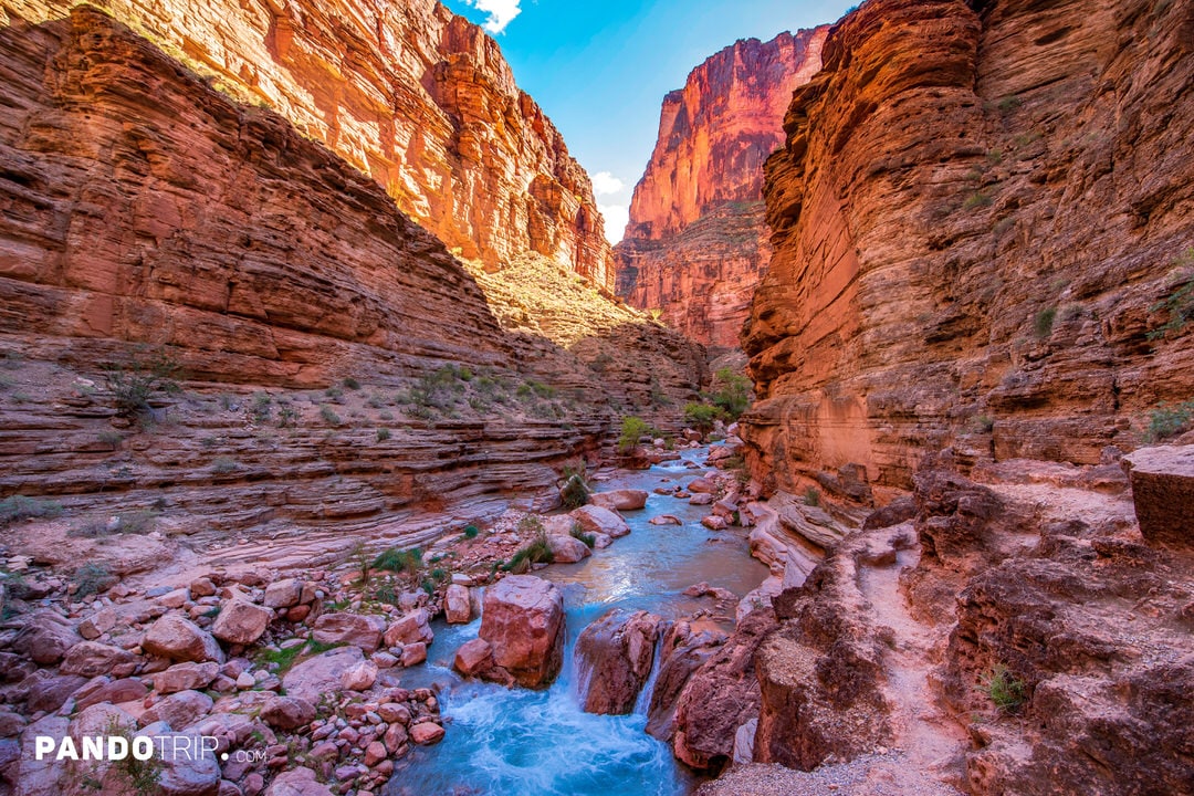
Havasu Creek is an important tributary of the Colorado River, flowing through the Grand Canyon. It starts as a small stream fed by snowmelt and rain, winding about 50 miles across flatlands. Upon reaching Cataract Canyon, the creek swells thanks to underground springs that feed it. From there, it travels 20 miles through the red rock landscapes of theHavasupai Tribe’s land before joining the Colorado River.
The creek is best known for its stunning turquoise-blue water and breathtaking waterfalls. Its distinct blue-green hue comes from magnesium and calcium absorbed from the surrounding rocks, forming calcium carbonate that reflects sunlight. This creates an incredible contrast with the red canyon walls, giving the place a true desert oasis vibe.
Along its journey, the creek forms several impressive waterfalls.The most famous is Havasu Falls, where water plunges 100 feet into a turquoise pool below – perfect for both Instagram shots and refreshing swims. Other notable falls include the secluded Mooney Falls, tucked into a narrow gorge, and the tiered beauty of Navajo Falls.
For the Havasupai Tribe, Havasu creek holds deep cultural significance. The tribe considers the creek and its waterfalls sacred, believing the water flows not just through the land but through every member of their community. For this reason, access to the area is strictly regulated, and visitors are only allowed with advance permits.
San Pedro Creek, USA
San Pedro Creek is one of the oldest documented waterways, with evidence of human settlement along its banks dating back 10,000–12,000 years. It played a key role in the founding of San Antonio. In 1718, Spanish explorers established a permanent settlement along the creek, making it a vital resource for the growing community, providing water for daily life and irrigation. In 1731, families from the Canary Islands arrived, solidifying the area as Texas’s first official civil settlement.
Throughout the early to mid-1900s, San Pedro Creek remained central to local industry. Various businesses and factories relied on its waters, such as the San Antonio Soap Works, which operated from 1849 to 1917. Unfortunately, recurring flood issues led to significant modifications to the creek, and in some areas, it was completely covered. These changes caused many to mistakenly view it as nothing more than a drainage ditch.
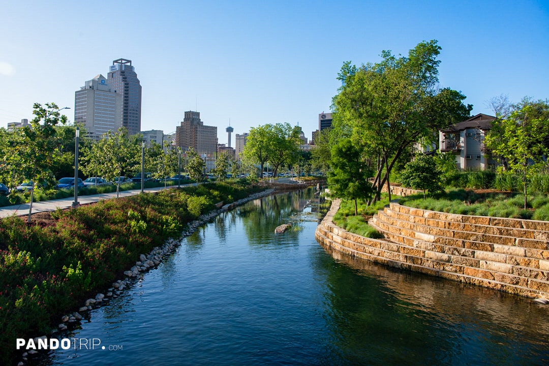
In the 21st century, recognizing the historical significance of San Pedro Creek, the idea of transforming it into a linear park took shape, leading to the San Pedro Creek Culture Park project. The project is being implemented in four phases, with the first two completed in 2018 and 2022. The third phase is currently underway, with completion expected by spring 2025.

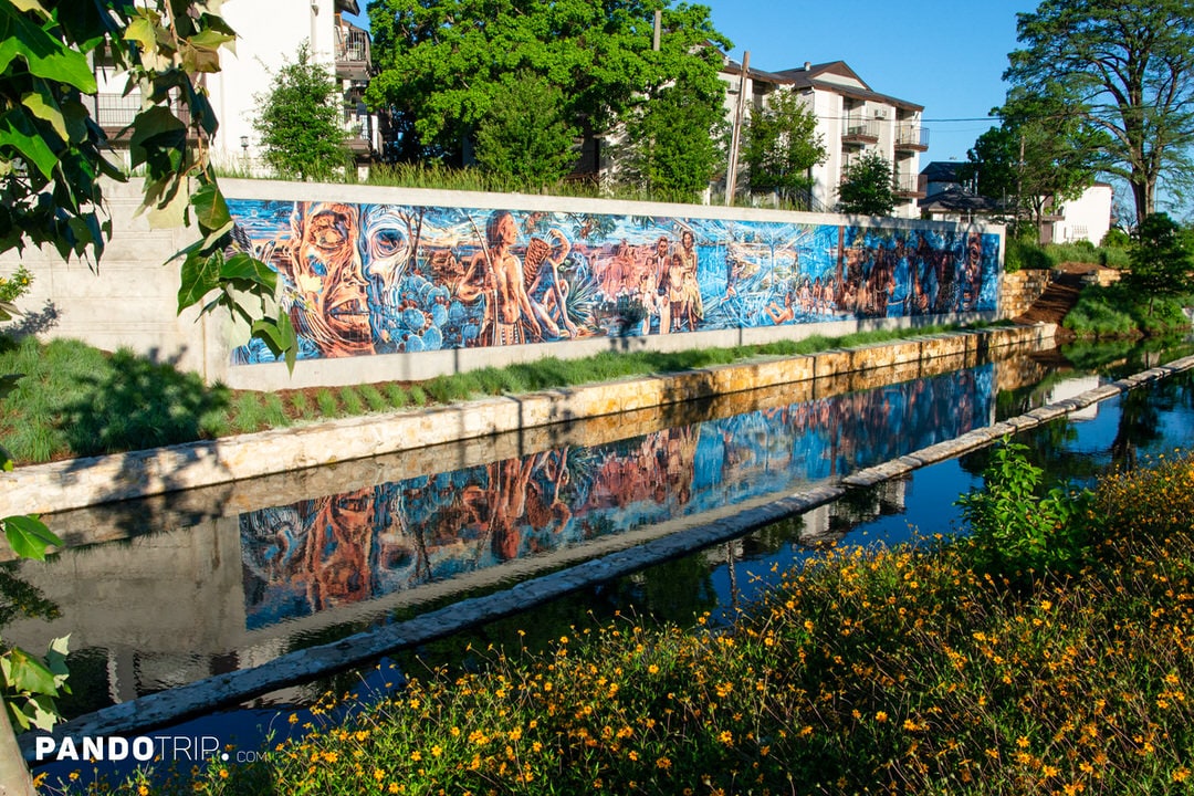

Today, the park has become a gathering space for locals and visitors alike, featuring art installations and historical exhibits. Visitors can stroll along scenic walking paths or enjoy picnics surrounded by native plants, reconnecting with the creek’s rich cultural and natural heritage.
Dubai Creek, UAE
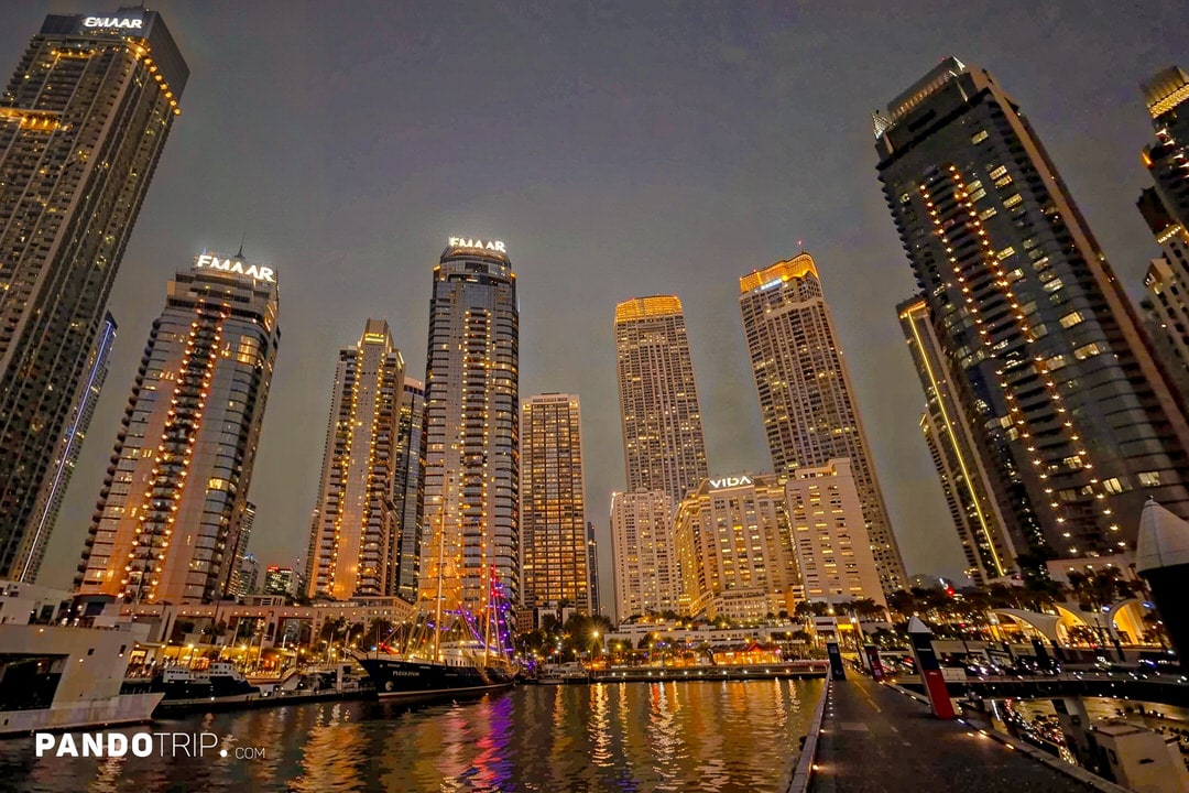
Dubai Creek, also known as Khor Dubai, is a great example of how a name doesn’t always match the geological definition. Unlike most creeks that have freshwater input from upstream sources, Dubai Creek is essentially an extension of the sea. The water is saline, and its flow is influenced more by tidal patterns than by the typical downstream flow we see in traditional creeks. Moreover, Dubai Creek is far from being a “small” body of water—it spans over 24kilometers in length and reaches widths of up to 1,200 meters in some places. It’s clear that the name reflects historicalusage rather than strict hydrological classification.
Historically, Dubai Creek has been a cornerstone of Dubai’s transformation from a humble fishing village to a global metropolis. As early as the 19th century, the Bani Yas tribe settled along its banks, establishing Dubai’s ruling Al Maktoum dynasty. The creek became a hub for pearl diving, fishing, and maritime trade, linking Dubai to India, East Africa, and Persia. In the early 20th century, when the creek was declared a free trade zone, it attracted merchants from across the region.
Recognizing the creek’s potential to boost trade, dredging and expansion projects began in the 1950s, eventually allowing ships weighing up to 500 tons to navigate its waters. Today, Dubai Creek remains a vital part of the city’s infrastructure and economy, handling over 13,000 vessels annually.

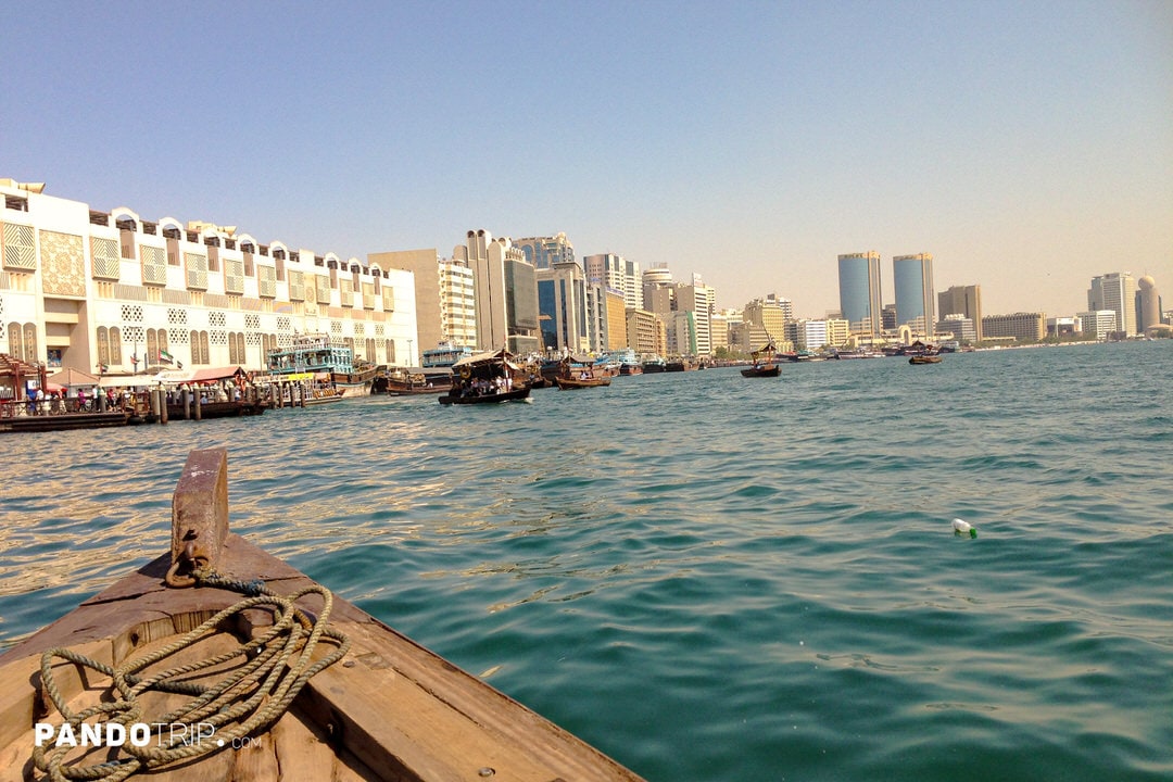
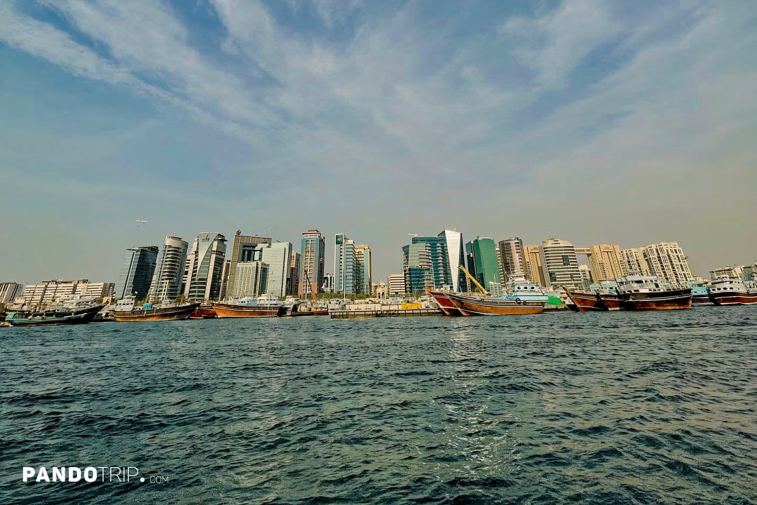
The creek divides the city into two main areas: Deira and Bur Dubai. Along its shores, you’ll find government offices, businesses, residential neighborhoods, and popular tourist attractions. The area is particularly famous for its traditional markets, or souks, where visitors can shop for gold, spices, and textiles. Visitors looking to experience the creek’s historic charm can take a ride on a traditional dhow boat.
Billabong Creek, Australia
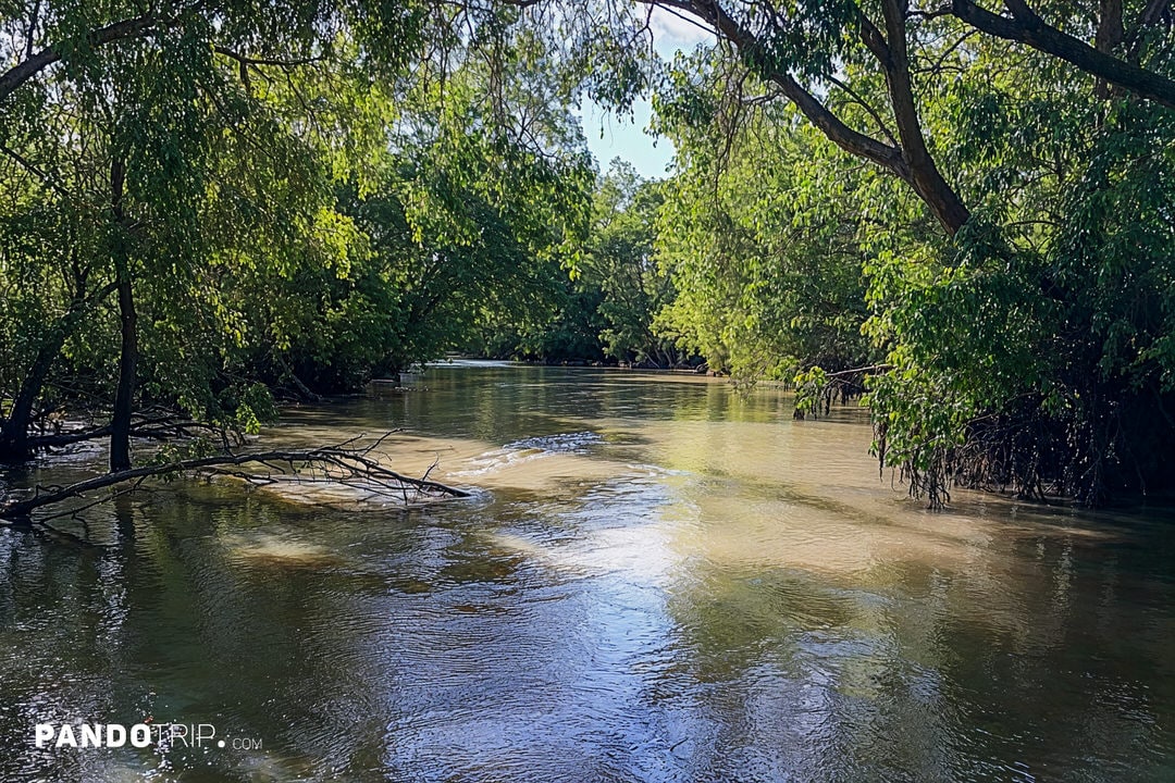
Dubai Creek may be impressive in size, but it doesn’t come close to Billabong Creek in Australia. Stretching 320 km (200 miles), Billabong Creek holds the title of the longest creek in the world. It forms near Holbrook, where Yarra Yarra Creek and Little Billabong Creek merge. Flowing westward, it passes through towns like Culcairn, Walbundrie, Jerilderie, and Moulamein before joining the Edward River, a significant tributary of the Murray River.
Billabong Creek is classified as an intermittent creek, meaning its flow can vary a lot depending on factors like rainfall, irrigation, and agricultural water use.
This creek flows through the traditional lands of the Wiradjuri people, where it has played a significant role for thousands of years. Archaeological evidence suggests human activity in the area dating back 60,000 years. It was also crucial during early European settlement, supporting farming and grazing activities. Over time, levees and flood control systems were introduced to manage the floodplain for


Moulamein, where Billabong Creek meets the Edward River, is considered a fishing hotspot, especially for catching Murray cod and golden perch (Yellowbelly). One of the town’s highlights is the annual spring fishing competition, sponsored by the Moulamein Football Netball Club.
Allt Coir’ a’ Mhadaidh, Fairy Pools, Scotland

Located in Scotland, on the Isle of Skye, the Fairy Pools are among the most breathtaking landscapes in the UK. They’re made up of a series of cascading waterfalls leading to a collection of pools of all sizes and depths. The waterfalls range in height from 2 to 7 meters, and the pools are famous for their crystal-clear water and vibrant blue hues.
While the stepped pools and cascading morphology, alternating between deeper basins and steeper falls, are typical of many mountain streams, the Fairy Pools are arguably one of the most stunning examples of this natural formation in the world. This makes them a favorite destination for photographers, as the pools and waterfalls are set against the dramatic backdrop of the rugged Black Cuillin mountains.
For the adventurous, swimming in these pools is a popular activity, though the water is famously cold. Some of the pools even feature natural arches and spots perfect for cliff-jumping into the crystal-clear water.


You might wonder, how does this relate to creeks? The Fairy Pools are part of an intriguing hybrid water feature that is technically part of the Allt Coir’ a’ Mhadaidh (translated as the “Burn of the Wolf’s Corrie”). In Scottish terms, a “burn” refers to a small river or creek, making Allt Coir’ a’ Mhadaidh essentially a creek.
This creek is formed by numerous tiny streams flowing down from the Cuillin Hills, fed by rainfall and snowmelt. The water then cascades through the series of waterfalls and pools—what we know as the Fairy Pools—before finally flowing into the River Brittle.
North Creek, USA
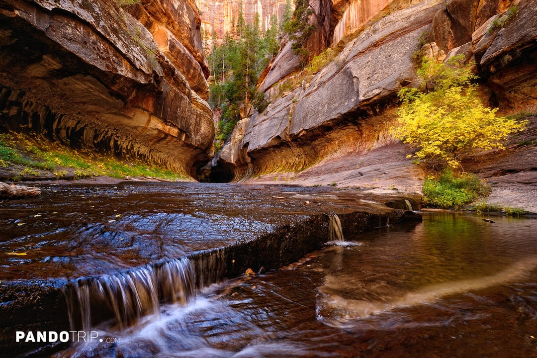
North Creek might not draw the same crowds as Zion’s famous Angels Landing hike (arguably one of the best adventures in the U.S.), but it’s still one of the most fascinating features of the park.
North Creek is a tributary of the Virgin River, flowing through the Kolob Terrace area of Zion National Park. It splits into two main branches: The Left Fork and The Right Fork, both showcasing the park’s iconic Navajo sandstone formations, carved over millions of years by erosion.


The Left Fork is the more popular branch, best known for The Subway, a slot canyon featuring unique tubular rock formations that resemble a subway tunnel. This hike is considered one of Zion’s most iconic, but you’ll need a permit to explore it. The trek involves scrambling over rocks, wading through water, and even swimming through narrow passages.
The Right Fork is far less crowded, and you won’t need a permit to explore it. This route is known for its lush scenery, pools, and waterfalls, including Double Falls and Barrier Falls.
Creeks of Karijini National Park, Australia
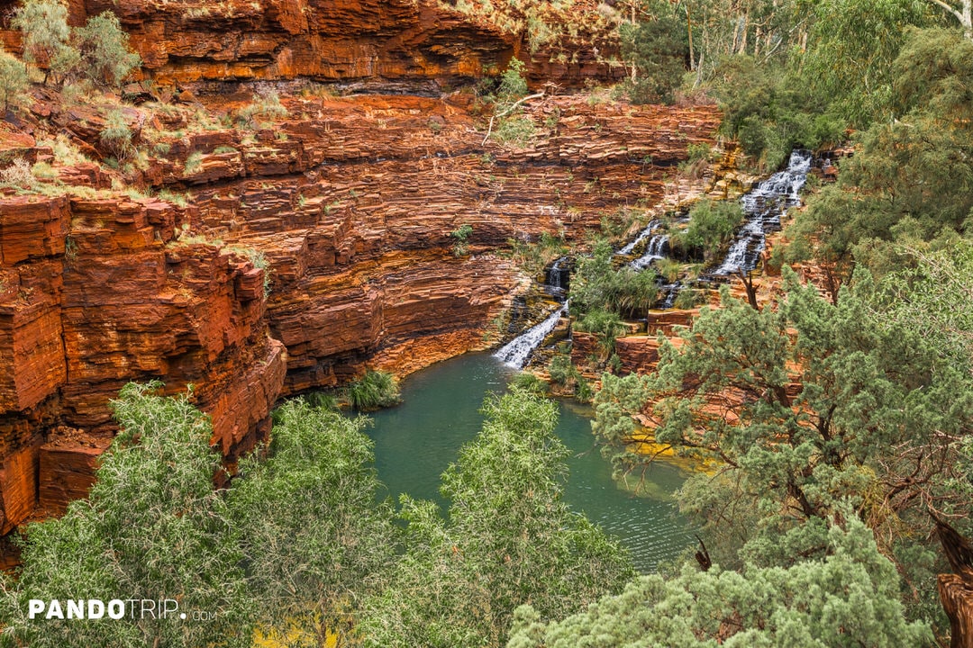
The second-largest national park in Western Australia, Karijini National Park, is famous for its red rock gorges, stunning waterfalls, and turquoise natural pools. Much of this landscape was shaped by creeks that have flowed through the park for centuries. While most of these creeks are seasonal, fed by rainfall, they play a crucial role in sustaining the park’s vegetation and creating its iconic pools and waterfalls.
The only permanent waterfall in Karijini is Fortescue Falls, located in Dales Gorge. Fed by the Fortescue Creek, the waterfall cascades into a large natural swimming pool below. Just 300 meters away in the same gorge is Fern Pool, a serene oasis surrounded by lush greenery and featuring a small waterfall.
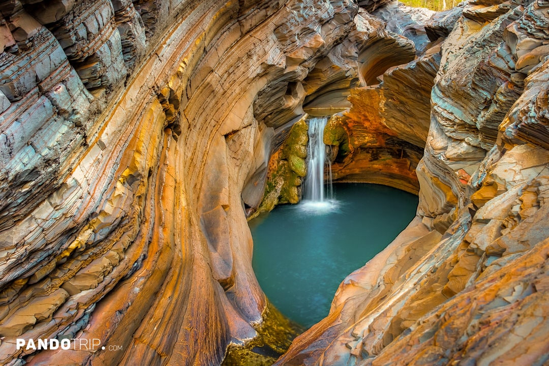
In Hamersley Gorge, you’ll find the famous Spa Pool, a small natural rock pool fed by a gentle waterfall. It’s not only a great spot to unwind but also incredibly photogenic, with its vibrant turquoise water framed by elegantly curved rock walls.


Other gorges, such as Hancock, Weano, and Kalamina, also feature creeks that flow into pools like Kermit’s Pool and Rock Arch Pool. These streams are often shallow and seasonal, depending on rainfall, adding to the dynamic beauty of the park.
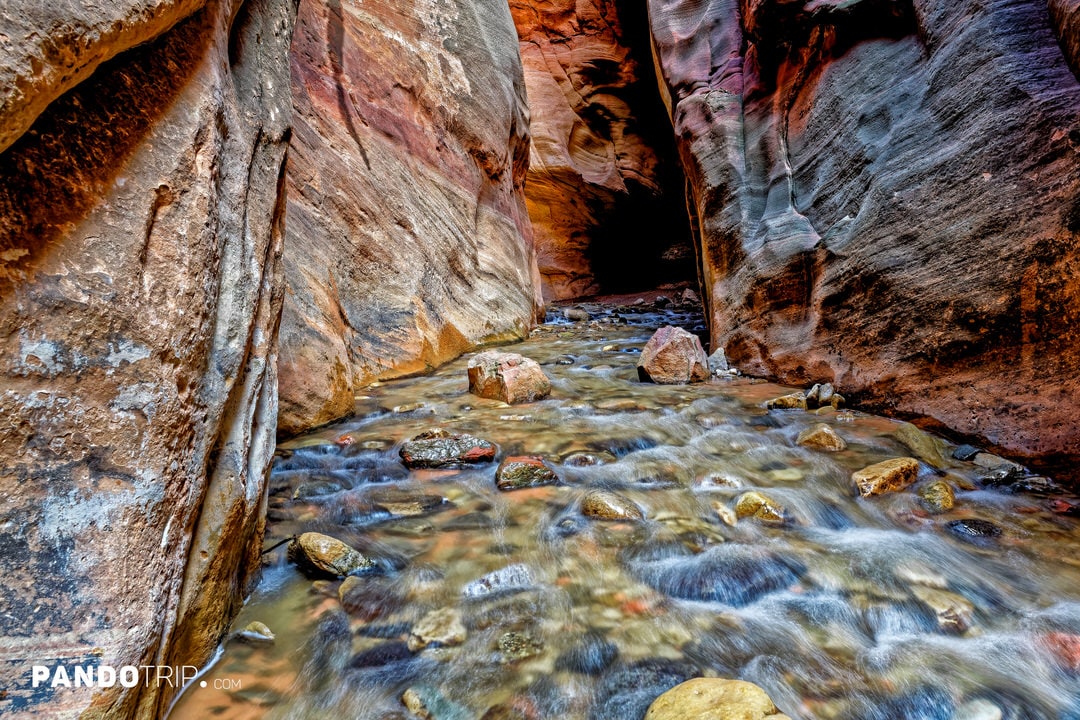
Kannara Creek, USA
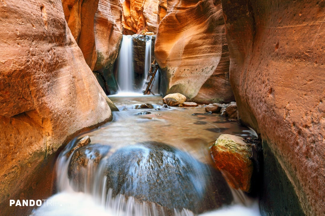
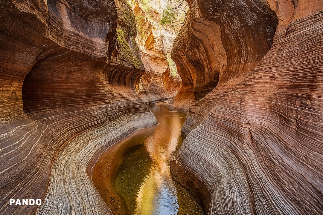
Another stunning creek on this list is Kannara Creek, located right next to North Creek. It’s about 11 km (7 miles) north of the Kolob Canyons section of Zion National Park, though it’s not actually part of the park. It flows year-round and, like North Creek, is a tributary of the larger Virgin River.
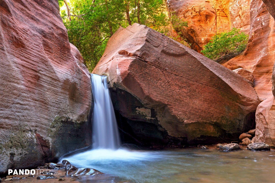
Kannara Creek winds through narrow sandstone canyons, creating a photogenic landscape with vivid orange and purple hues. The highlights of the hike are two waterfall sections, where ladders have been installed to help visitors climb past the falls.
The hike along Kanarra Creek is often called a “mini Zion Narrows” because it offers a similar experience to the famous Zion Narrows hike in Zion National Park but on a smaller scale. Both involve wading through water for much of the journey and navigating various obstacles. However, unlike the busy Zion Narrows, Kanarra Creek is quieter thanks to a permit system that limits visitors to just 150 per day.